
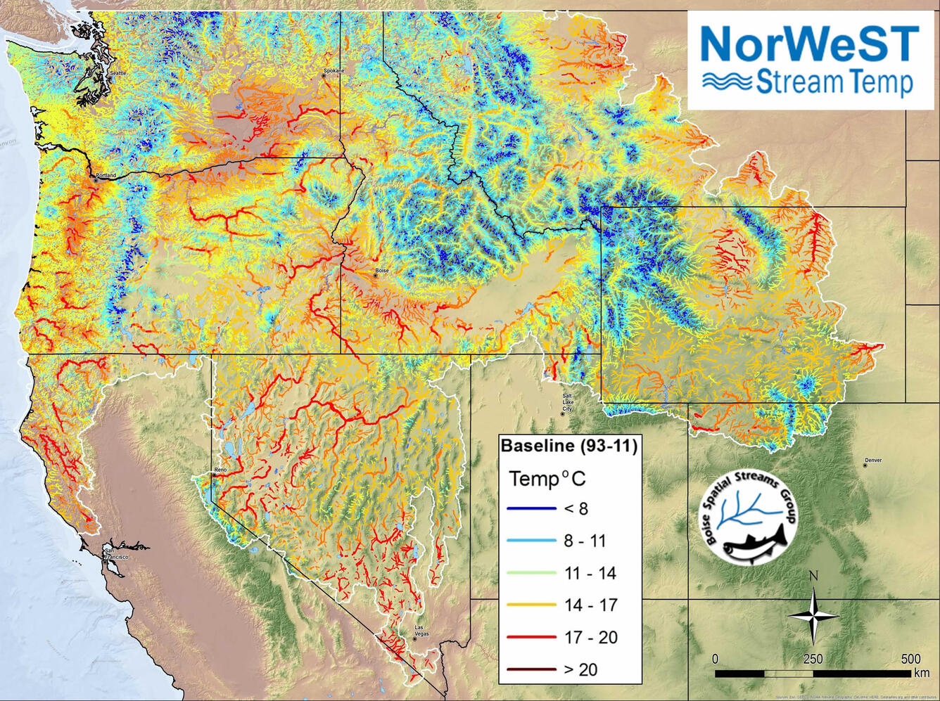
NorWeST stream map
Detailed Description
Northwest United States temperature and climate map developed from data at more than 16,000 sites that was used to highlight climate refugia for mountain stream species. Photographer: Dan Isaak, U.S. Forest Service, disaak@fs.fed.us