
PAD-US flyer2 - July 2016.jpg
Detailed Description
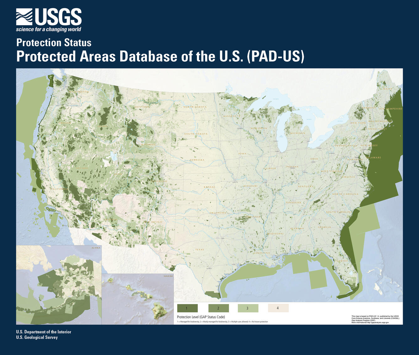
Protected areas illustrated by GAP Status Code from the PAD-US geodatabase. GAP Status Code is a measure of management intent to protect biodiversity, useful for conservation applications. GAP Status Code 1, 2 and 3 areas are permanently protected from conversion to agriculture or development. Areas primarily managed for the conservation of nature are identified as GAP 1 or 2, while areas managed for multiple uses (including conservation) are GAP 3. Private lands or areas with no known protection mandate are depicted as GAP Status Code 4.