
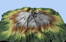
A perspective view of Mount hood
By National Geospatial Program
2017 (approx.)

Detailed Description
A perspective view of Mount hood, made from the OR_Sandy_River_2007 lidar data
Sources/Usage
Public Domain.