
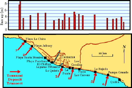
Peru tsunami transects with runup measurements

Detailed Description
Location of tsunami deposit transects along the southern Peruvian coast near Camaná, approximately 700 km (435 miles) southeast of Lima, Peru. Transects were made at six sites: (1) Playa la Chira, (2) Playa Jahuay, (3) La Quinta, (4) Amecosupe, (5) La Bajada, and (6) Pampa Grande. Runup measurements, plotted on the graph above the map, include measurements from this survey and the 1st International Tsunami Survey Team.