
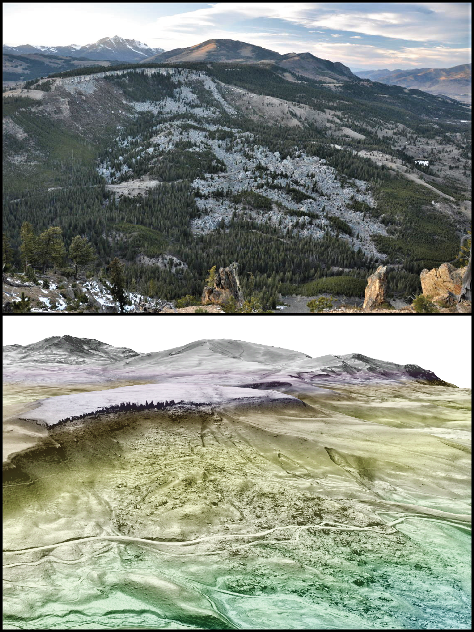
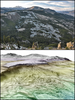
Photo and lidar image of Silver Gate landslide, Yellowstone National Park
By Yellowstone Volcano Observatory
February 2022 (approx.)

Detailed Description
Top image is a view of the Silver Gate landslide complex, near Mammoth Hot Springs, from Bunsen Peak. Bottom shows roughly the same view using lidar data, colored to show elevation highs and lows and shaded by slope. Landslide scarps, roads, trails, and Glen Creek (lower left), all obscured by trees in the photograph, are much more visible in the lidar. (Photo by Michael Poland, lidar data from USGS 3DEP over slope map visualized in ArcGIS Pro.)
Sources/Usage
Public Domain.