
Point misclassification lidar error
By NGP Standards and Specifications
2021 (approx.)
Detailed Description
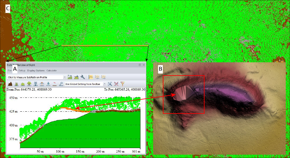
Lidar error dictionary figure 23. Elevation profile (A) and digital elevation model (B) show a void due to misclassification of ground points. Elevation profile taken along double line shown in lidar point cloud image (background, C).
Sources/Usage
Public Domain.