
Post-Glacial Isostatic Adjustment in Virginia

Detailed Description
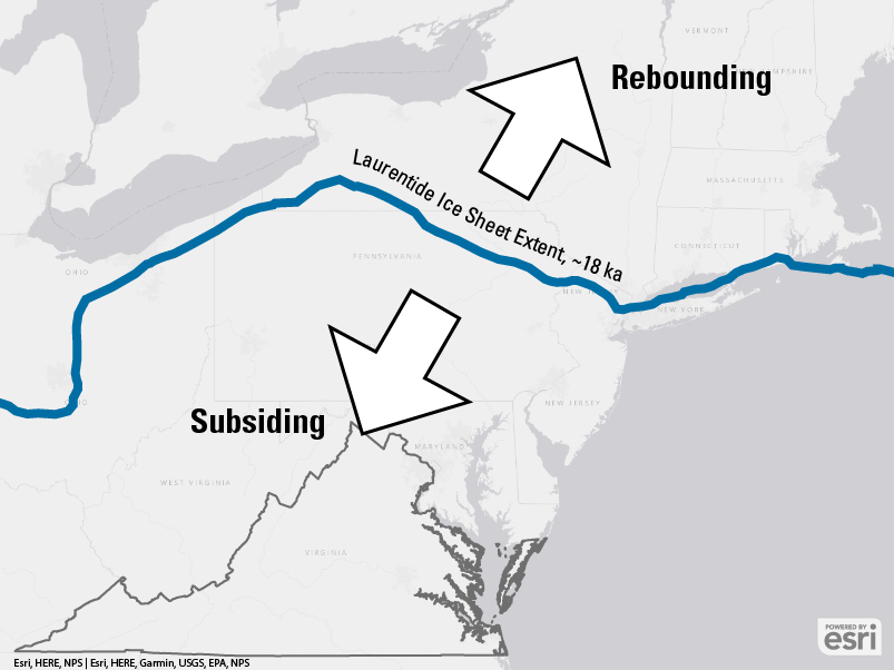
The Laurentide Ice Sheet covered large portions of North America during the Pleistocene. This map of the northeastern United States shows the location of the Laurentide Ice Sheet's southern margin (blue line) 18 thousand years ago, which is close to the last glacial maximum in North America.
Though it never extended as far south as Virginia, the ice sheet's historic presence still affects land subsidence rates in Virginia to this day. Due to post-glacial isostatic adjustment, the land north of the ice sheet's historic margin is rebounding, while the land immediately to the south of the historic margin is subsiding due to forebulge collapse.
Sources/Usage
Public Domain.
Adapted from:
Dalton, A.S. et al, 2020. An updated radiocarbon-based ice margin chronology for the last deglaciation of the North American Ice Sheet Complex. Quaternary Science Reviews, 234, p.106223. https://doi.org/10.1016/j.quascirev.2020.106223