
Puerto Rico Seismic Hazard Map

Detailed Description
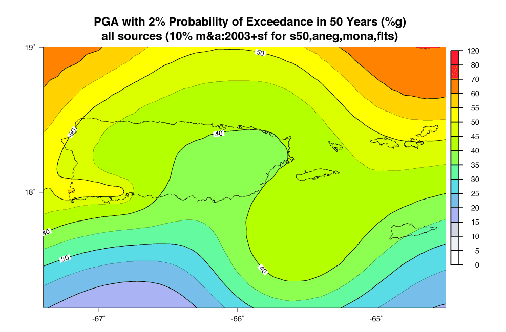
Puerto Rico seismic hazard map showing peak ground acceleration (%g) total mean hazard map for 2% probability of exceedance in 50 years for a firm rock site (VS30 = 760 m/s).
Sources/Usage
Public Domain.