
RCMAP Data Showing Tree Encroachment in Nevada
By Earth Resources Observation and Science (EROS) Center
2023 (approx.)
Detailed Description
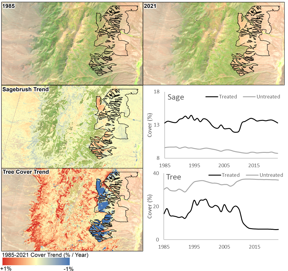
Pinyon-Juniper encroachment is a major driver of change across the Great Basin. Land managers often target encroached areas for treatment. Landsat imagery shows the impact of this treatment (black polygon). RCMAP 1985-2023 trends show declining tree cover and increased sagebrush cover as a result. Prior to the 2011 treatment, sagebrush was declining as tree cover expanded.
Sources/Usage
Public Domain.