
Researchers Record Slow, Unsteady Movement on South Flank of Kīlauea
Detailed Description
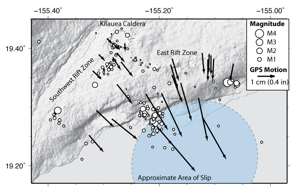
Earthquakes (white circles) and deformation recorded by GPS instruments (black arrows) on Kīlauea Volcano during the recent slow earthquake that began on October 14, 2015. Circle size indicates earthquake magnitude and arrow length indicates the amount of motion measured by GPS instruments (see legend, upper right, for scales). The light blue circle shows the approximate area at about 10 km (6 mi) below the surface that slipped during the event. USGS map.
Sources/Usage
Public Domain.