
Resolve low-level flight system
By Communications and Publishing
October 2015 (approx.)
Detailed Description
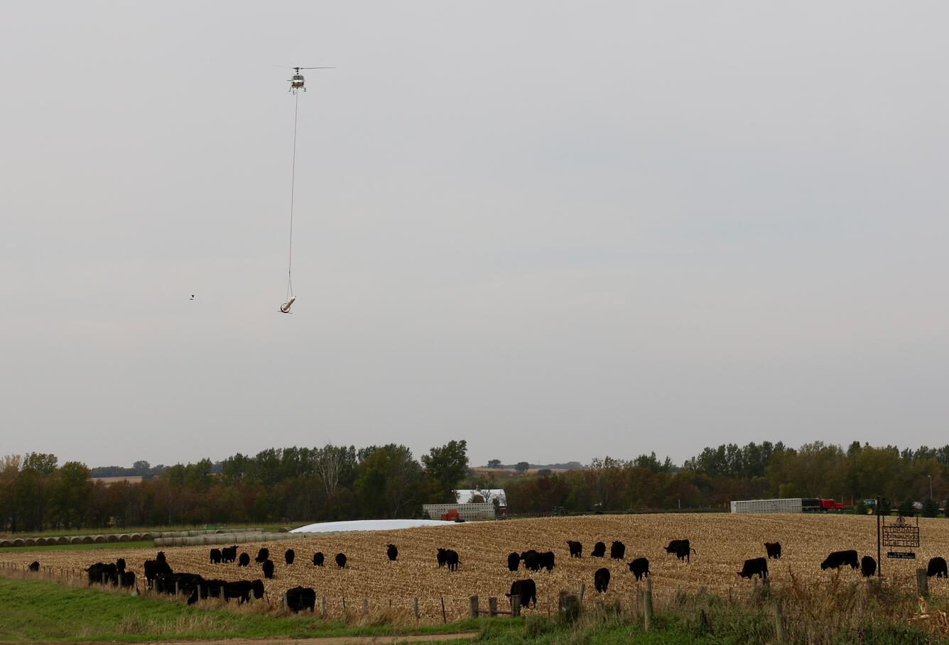
In this image, a helicopter towing a large, cylindrical sensor makes low-level flights as part of a USGS remote geophysical survey, which collects data about underground geology. The scientific system, called Resolve, is operated by CGG Canada Services, Ltd.
Sources/Usage
Public Domain.