
Satellites are now an essential tool for tracking lava flows
Detailed Description
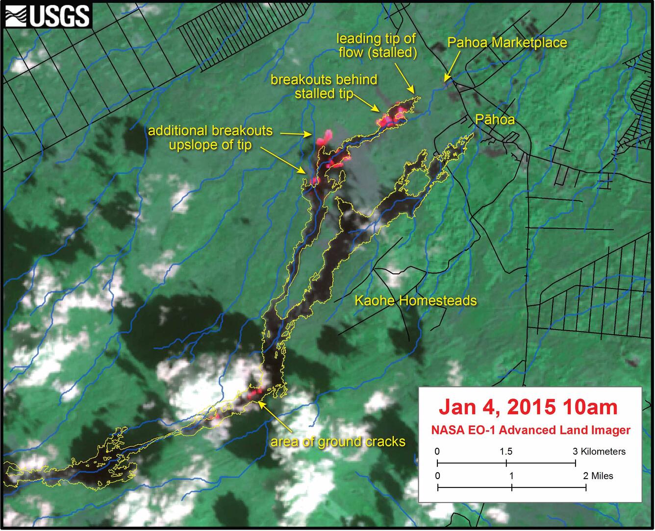
This satellite image was captured on Sunday, January 4, 2015, by the Advanced Land Imager instrument onboard NASA's Earth Observing 1 satellite. Bright red pixels depict areas of high temperature and indicate active lava. White areas are clouds. The yellow outline is the flow margin as mapped on Tuesday, December 30. Using satellite images like this, HVO scientists can remotely map the expansion of flow margins. Image courtesy of NASA's Jet Propulsion Laboratory.