
Seafloor-change maps

Detailed Description
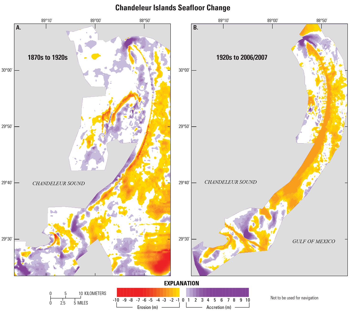
Seafloor-change maps created by digitizing historical bathymetry and collecting data during the State of Louisiana Barrier Island Comprehensive Monitoring (BICM) program for the northern Chandeleur Islands from (A) the 1870s to the 1920s and from (B) the 1920s to 2006/2007. Warm colors denote erosion, and cool colors show deposition of sediment around the islands (modified from BICM Volume 5).
Sources/Usage
Public Domain.