
Seafloor mapping systems
By Woods Hole Coastal and Marine Science Center
2017 (approx.)

Detailed Description
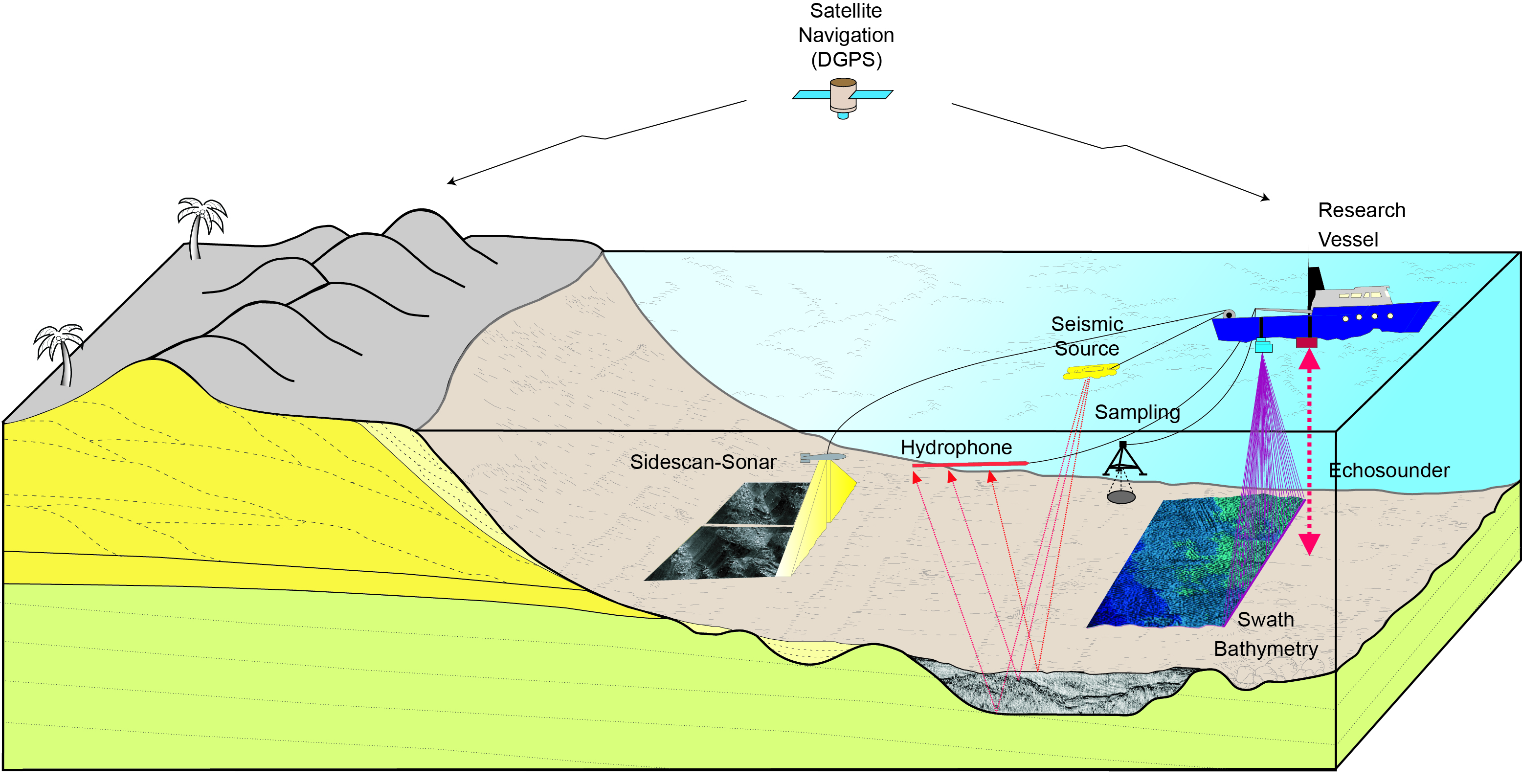
Graphic showing geophysical and sampling systems used to define the seafloor topography, surface sediments, and underlying geology. Sidescan-sonar systems acquire information about the surface of the seafloor, swath bathymetric systems measure the depth, or seafloor topography, seismic sources map the underlying geologic structure, single-beam echosounders map the depth at a point beneath the vessel, and sampling systems collect samples of the seafloor and can be equipped with digital camers and video systems to collect optical images of the seafloor.
Sources/Usage
Public Domain.
Related Content

Sea Floor Mapping Group
The Sea Floor Mapping Group (SFMG) is a core capability at the Woods Hole Coastal & Marine Science Center (WHCMSC) that provides support for coastal, lacustrine and marine geologic research. The staff has a wide-range of expertise and is responsible for geophysical and sampling data acquisition, processing, interpretation and publication, logistics, design, and research and development. SFMG has...
Related Content
Sea Floor Mapping Group
The Sea Floor Mapping Group (SFMG) is a core capability at the Woods Hole Coastal & Marine Science Center (WHCMSC) that provides support for coastal, lacustrine and marine geologic research. The staff has a wide-range of expertise and is responsible for geophysical and sampling data acquisition, processing, interpretation and publication, logistics, design, and research and development. SFMG has...