
Seafloor Offshore of Half Moon Bay
By Pacific Coastal and Marine Science Center
2012 (approx.)

Detailed Description
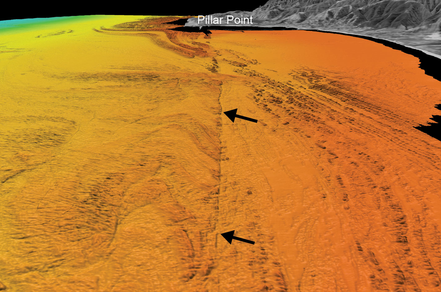
Perspective view of seafloor offshore of Half Moon Bay, showing scarp (arrows) along the eastern strand of the San Gregorio fault zone. Rocks are notably upwarped and folded adjacent to the fault.
Sources/Usage
Public Domain.
California State Waters Map Series—Offshore of Half Moon Bay, California
This comes specifically from Sheet 4, Data Integration and Visualization, and shows the colored shaded-relief bathymetry and various perspective views and bathymetric profiles combined with video-mosaic images created from seafloor digital video.