
Seismic ground velocity signals
By Hawaiian Volcano Observatory
2013 (approx.)
Detailed Description
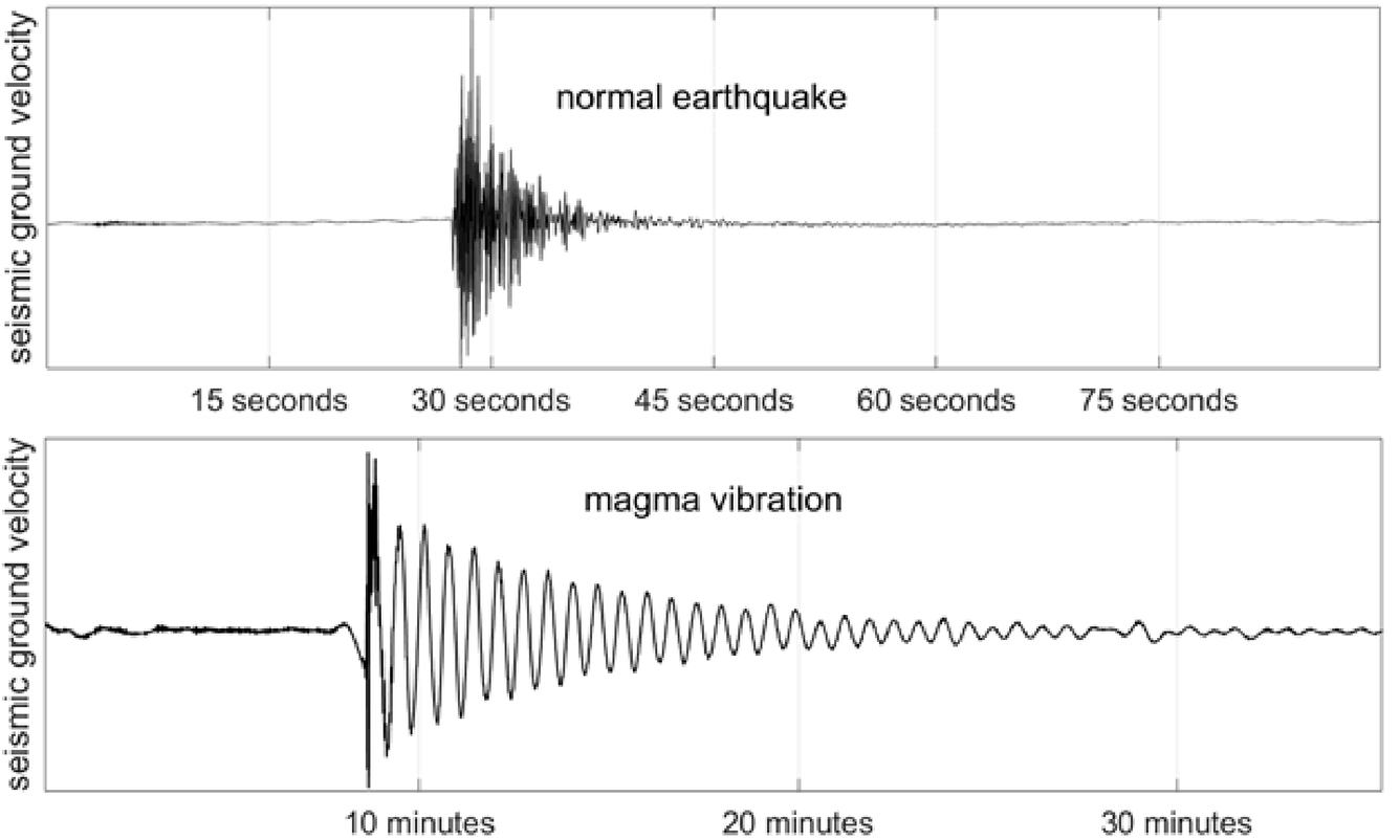
The top plot shows a 2013 seismic recording of a normal shallow magnitude-2 earthquake that occurred a few miles south of the summit of Kīlauea Volcano. The bottom plot shows a 2013 seismic recording of magma resonance after a large rock broke off the Halema‘uma‘u crater walls at the summit of Kīlauea Volcano and then impacted the lava lake surface. Note the different timescales; the normal earthquake only lasted for about 20 seconds in total, whereas each magma oscillation cycle lasted for 40 seconds and the vibrations continued for over 20 minutes in total.
Sources/Usage
Public Domain.