
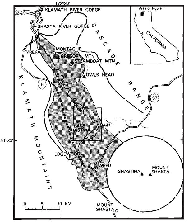
Sketch map of Shasta Valley debris-avalanche deposit (shaded).
By Volcano Hazards Program
1984 (approx.)
Detailed Description
Heavy dashed lines show approximate margins of Shasta Valley and base of Mount Shasta volcano; dotted line indicates western edge of Quaternary basalt.
Sources/Usage
Public Domain.
Crandell et. al., 1984