
A small but notable magma intrusion at Kīlauea’s summit
By Kīlauea

Detailed Description
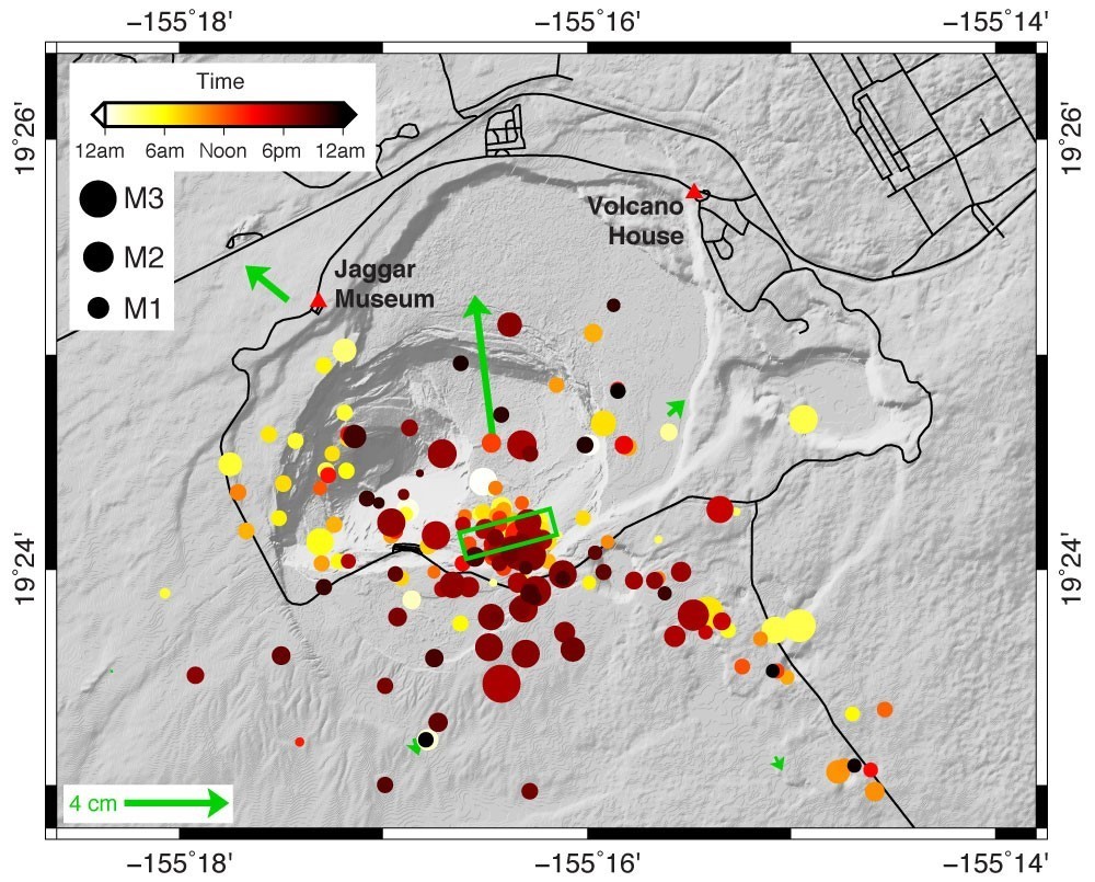
Map showing locations of earthquakes at Kīlauea’s summit on December 2, 2020. Motion detected by HVO’s GPS monitoring network is shown as green arrows. The length of the arrow corresponds to the amount of motion and the direction it points shows the direction of motion. Earthquakes are plotted as circles with color corresponding to the time of day they occurred, and size scaled according to earthquake magnitude. The green box shows the minimum size of the magma intrusion, as constrained by ground deformation. The intrusion model shows opening of a rectangular surface with its top edge to the south-southeast that trends downward to the north-northeast at an angle of 40–60 degrees. Black lines are local roads.
Sources/Usage
Public Domain.