
Small-scale map of June 27th flow in Kīlauea's ERZ

Detailed Description
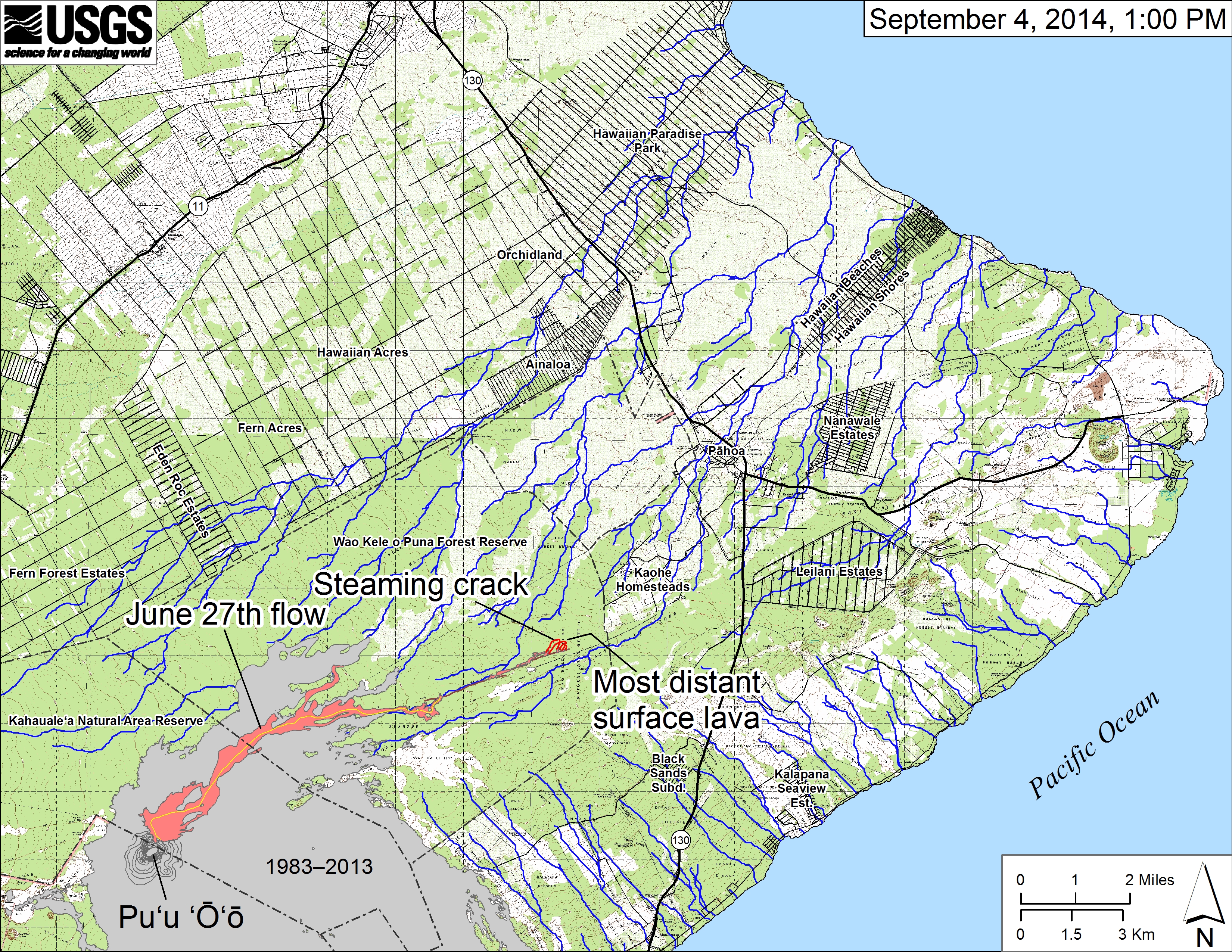
Small-scale map showing the June 27th flow in Kīlauea's East Rift Zone as of September 4, 2014. Lava on the surface at 1 PM, outlined in red, was 13.3 km (8.3 miles) from the vent and 1.2 km (0.7 miles) from the east boundary of the Wao Kele o Puna Forest Reserve. The front of the flow was spilling into another crack, which was steaming. The blue lines show down-slope paths calculated from a 1983 digital elevation model (DEM). All older lava flows (1983-2014) are shown in gray; the yellow line marks the lava tube. For an explanation of down-slope path calculations see: http://pubs.usgs.gov/of/2007/1264/.
Sources/Usage
Public Domain.