
Small-scale map of June 27th flow in Kīlauea's ERZ
Detailed Description
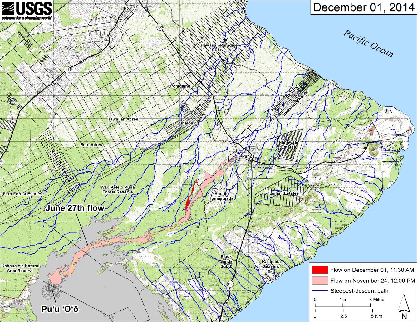
This small-scale map shows the June 27th lava flow in relation to lower Puna. The area of the flow on November 24, 2014, at 12:00 PM is shown in pink, while widening and advancement of the flow as mapped on December 1 at 11:30 AM is shown in red.
Most surface flow activity is focused into a narrow finger that branches off the west edge of the flow field north of the East Rift Zone crack system. The front of this finger was 4.6 km (2.9 mi) upslope from the intersection of Highway 130 and Pāhoa Village Road at the Pahoa Marketplace. Breakouts were also active in three other general locations: where the narrow finger branches from the older flow, at the eastern edge of the flow field within the crack system, and about 3.5 km (2.2 mi) downslope from Pu‘u ‘Ō‘ō.
The blue lines show steepest-descent paths calculated from a 1983 digital elevation model (DEM; for calculation details, see http://pubs.usgs.gov/of/2007/1264/). Steepest-descent path analysis is based on the assumption that the DEM perfectly represents the earth's surface. DEMs, however, are not perfect, so the blue lines on this map can be used to infer only approximate flow paths. All older Pu‘u ‘Ō‘ō lava flows (1983-2014) are shown in gray; the yellow line marks the active lava tube.
Sources/Usage
Public Domain.