
Small-scale map of Kīlauea's ERZ flow field
Detailed Description
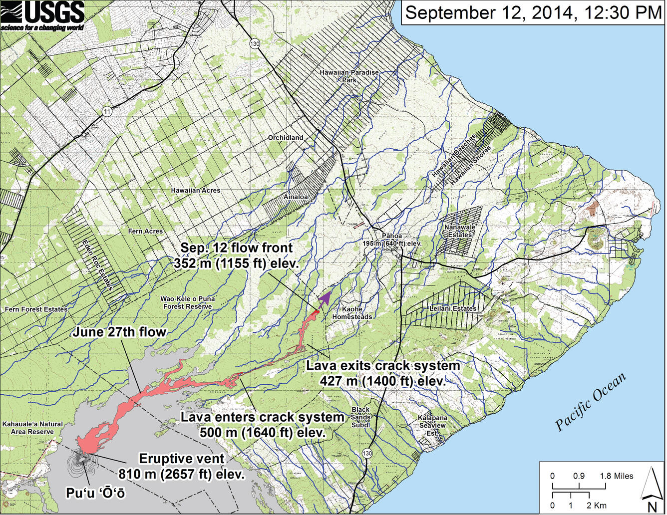
This small-scale map shows the June 27th flow in Kīlauea's East Rift Zone on September 12, 2014. The area of the flow on September 10, 2014, at 2:45 PM is shown in pink, while widening and advancement of the flow as mapped on September 12 at 12:30 PM is shown in red. The front of the active flow was 14.9 km (9.3 miles; straight-line distance) from the vent and 0.17 km (0.1 miles) from the east boundary of the Wao Kele o Puna Forest Reserve. The actual length of the flow, measured along the lava tube axis (so that bends in the flow are considered) is 17.1 km (10.6 miles). The flow was advancing toward the northeast. The blue lines show down-slope paths calculated from a 1983 digital elevation model (DEM). For an explanation of down-slope path calculations, see: http://pubs.usgs.gov/of/2007/1264/. All older Pu‘u ‘Ō‘ō lava flows (1983-2014) are shown in gray. Down-slope path analysis is based on the assumption that the digital elevation model (DEM) perfectly represents the earth's surface. But, DEMs are not perfect, so the blue lines on this map indicate approximate flow path directions. The purple arrow shows a short term projection of flow direction based on the flow behavior over the past several days and the local topography.
Sources/Usage
Public Domain.