
StreamStats User Interface Diagram
Detailed Description
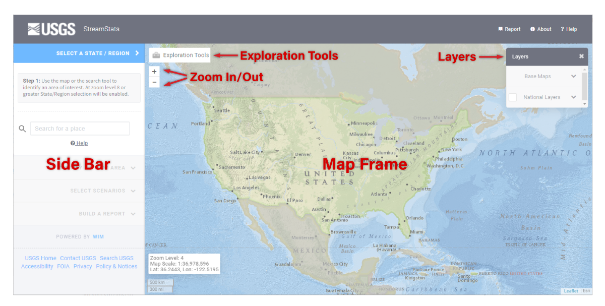
The Map Frame, forming the major part on the user interface, displays base maps and additional map layers, such as streamgage locations. The map is used primarily to locate places of interest and get information. Initially, the map is focused on North America.
Within the Map Frame are buttons for changing the scale of the map (zooming in and out), viewing the map legend and selecting map layers, and accessing the Exploration Tools, which are discussed in the Exploration Tools section.
The Sidebar, to the left of the Map Frame, presents a series of banners that will open like an accordion when the banner is selected to expose a panel with instructions in a gray box just below the banner and tool buttons below the instructions. The active banner will appear in dark blue. Inactive banners appear in light gray. The provided instructions guide the user through the steps necessary to delineate a basin, calculate basin characteristics, and compute flow statistics and other scenarios. In some cases, the banners will allow users to complete custom functions for a specific state or region.
Sources/Usage
Public Domain.