
topoBuilder Infographic

Detailed Description
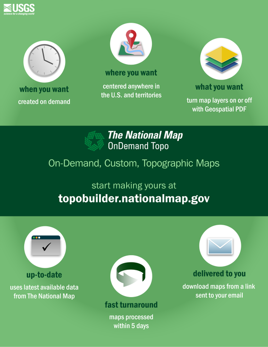
topoBuilder & OnDemand Topo Capabilities
- Choose your extent: Traditional 7.5-minute USGS Quadrangle or User-Centered Equivalent Extent
- Choose your region:
- 1:24,000-Scale CONUS & Hawaii
- 1:25,000-Scale Alaska
- 1:20,000-Scale Puerto Rico & other U.S. Territories
- Choose your level of on-the-fly contour smoothing: Low, Medium, or High (Fig. 3)
- Choose your desired format: Geospatial PDF or GeoTIFF Output
Once the customizations have been set, users need to enter a valid email address and within five days a direct link to download their unique map product will delivered, free of charge.
Sources/Usage
Public Domain.