
Topographic QLs Table 2. Requirements for lidar survey check points

Detailed Description
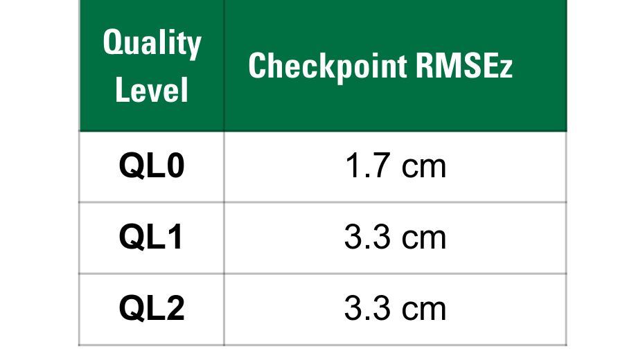
Table 2. Requirements for lidar survey check points expressed as root mean square error in the vertical (z) direction.
Quality Level Check point RMSEz
QL0 = 1.7 cm
QL1 = 3.3 cm
QL2 = 3.3 cm
Sources/Usage
Public Domain.