
Tsunami wave inundation extent in Peru, 2001
By Pacific Coastal and Marine Science Center
September 2001 (approx.)

Detailed Description
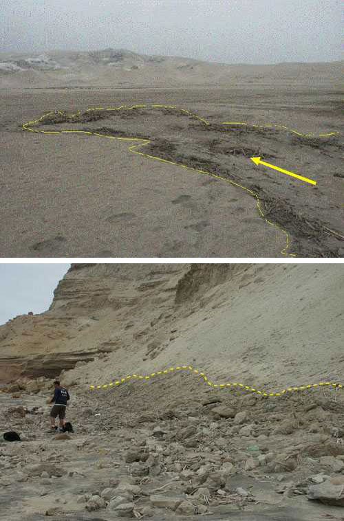
Top photo: The limit of tsunami inundation was marked by lines of woody debris and often followed lows in topography, as seen on the beach at Pampa Grande. Bottom photo: The inundation line at Playa la Chira is marked by a line of debris and a color change on the slope above the beach. The highest run-up measured by the survey (8.2 m) was along this stretch of beach.