UAS Point Cloud from USGS Fall Creek Lake OR Bathymetry project 11/16

Detailed Description
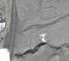
UAS Point Cloud from USGS Fall Creek Lake OR Bathymetry project, November 2016. Image center coordinate 43.946 latitude, -122.754 longitude

Official websites use .gov
A .gov website belongs to an official government organization in the United States.
Secure .gov websites use HTTPS
A lock () or https:// means you’ve safely connected to the .gov website. Share sensitive information only on official, secure websites.
UAS Point Cloud from USGS Fall Creek Lake OR Bathymetry project, November 2016. Image center coordinate 43.946 latitude, -122.754 longitude