
United States Fire Risk - First Street Foundation
By Earth Resources Observation and Science (EROS) Center
2021 (approx.)

Detailed Description
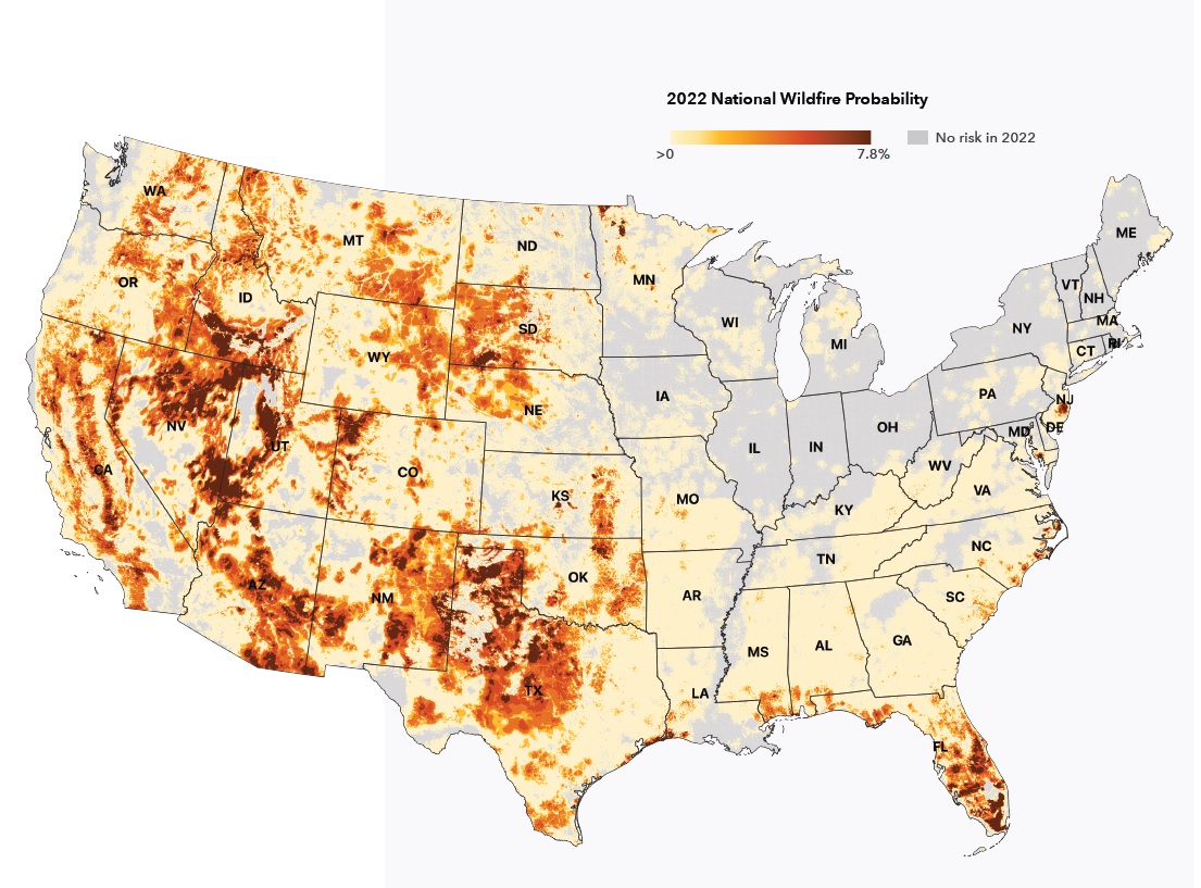
Fire risk map of the United States for 2022, from First Street Foundation report "Fueling the Flames." The report and the foundation's "Risk Factor" online tool were informed by data from LANDFIRE, a multi-agency federal partnership that uses USGS Landsat data to map fuels, vegetation, disturbances and more across the United States.
Sources/Usage
Public Domain.
(image courtesy of First Street Foundation)