
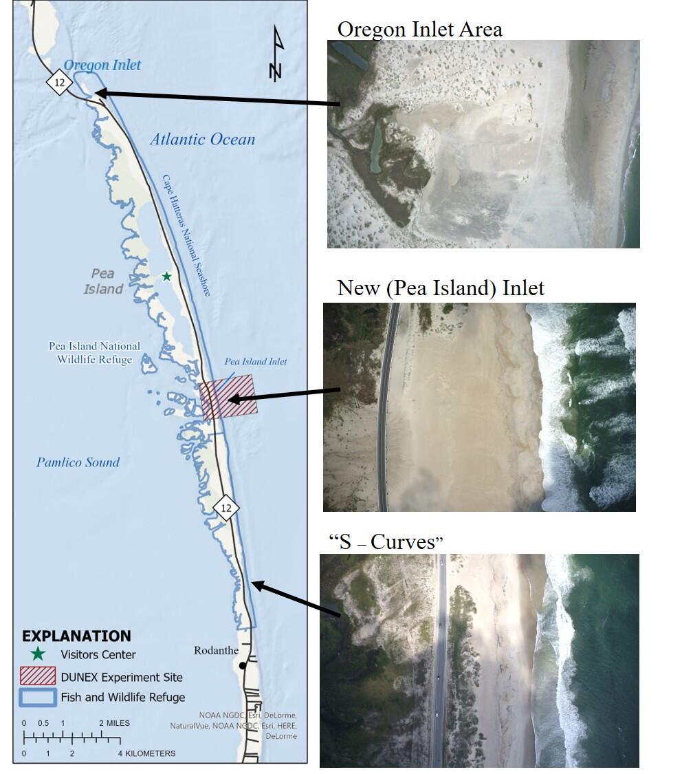
Vulnerable Areas on Pea Island
Detailed Description
A map and aerial imagery of Pea Island's most vulnerable sections: The south side of Oregon Inlet, New Inlet (also called Pea Island Inlet on some maps), and the "S-Curves" just north of Rodanthe are shown in detail. Aerial imagery is from a USGS flight on 2021-09-28
Sources/Usage
Public Domain.