
Create Your Own NHD State Product
Been missing the NHD state downloadable products? We’re working on a fix, but in the meantime, here are instructions for DIY versions of the NHD state products.
National Hydrography Dataset (NHD) state products are usually automatically refreshed bi-monthly (Feb, Apr, Jun, Aug, Oct, Dec) and available at the Hydrography downloadable products website and The National Map. However, the system responsible for producing these products is currently experiencing software limitations when performing the extraction process for the NHD state products and these products have not updated recently. USGS has redesigned the extraction process and is currently testing output products.
In the meantime, users can follow the instructions below.
Create NHD state products using ArcMap tools
- Request a list of HU8s contained in the state of interest by emailing National Hydrography Support. The USGS will process this request and provide a list of HU8’s back to the user.
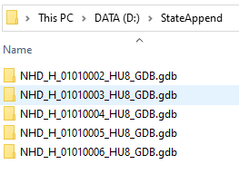
- Download all HU8 geodatabase (GDB) data for the state of interest on the NHD Downloadable Products Page.
► Remember, hydrologic boundaries do not typically follow state boundaries. - Unzip all files and move them into a single folder.
- Open ArcCatalog.
Media
 Sources/Usage: Public Domain. View Media Details
NHD State Product Step 5 - Remove the geometric network (HYDRO_NET in the Hydrography feature dataset) by right clicking the HYDRO_NET file and selecting delete. Select ‘yes’ to remove all associated files. Do this for each GDB that is to be merged.
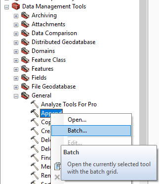
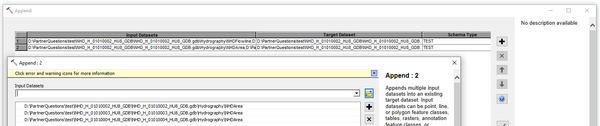
- Utilize batch processing in the Append tool in ArcMap to combine each dataset’s feature classes and tables into one geodatabase. (The USGS recommends appending to the lowest numbered HU). Both Hydrography and WBD feature datasets, as well as all tables, must be appended.
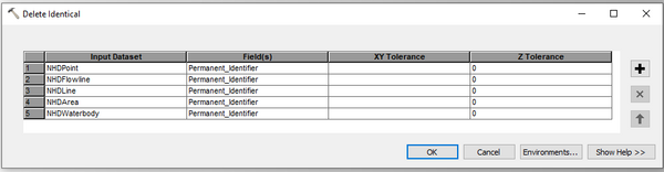
- Run the Delete Identical tool on the NHD feature classes: NHDFlowline, NHDWaterbody, NHDArea, NHDLine, and NHDPoint using the 'Permanent_Identifier' field to find identical records for deletion. Utilize the batch processing feature in the tool to run it on multiple feature classes at a time.
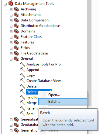
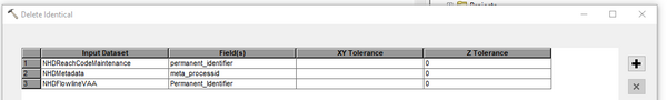
- Run the Delete Identical tool on the following NHD tables and fields: 'NHDReachCodeMaintenance' (Permanent_Identifier), 'NHDMetadata' (Meta_ProcessID), 'NHDFlowlineVAA' (Permanent_Identifier) using the batch processing feature.
►TIP: If needed, the geometric network can be built manually following these directions. If that link is not available, please send a request to National Hydrography Support.
*Any use of trade, product, or firm names is for descriptive purposes only and does not imply endorsement by the U.S. Government.