
End of an era: Historic Landsat 7 mission takes final images
Retiring satellite makes way for upcoming enhanced science mission
RESTON, Va. — After more than 132,000 trips around the Earth and more than 3.3 million satellite images under its belt, the work of the Landsat 7 satellite is complete, even as the Landsat science mission continues with newer satellites.
A joint mission between the U.S. Geological Survey (USGS) and NASA, Landsat 7 was initially designed for a five-year mission. Beating the odds, the satellite observed the Earth for a quarter-century, delivering invaluable scientific data for the benefit of all humanity.

Landsat 7 captured one of its final images on May 28 over Las Vegas, Nevada.


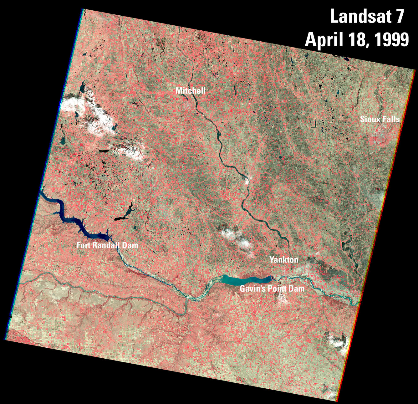
Since its launch on April 15, 1999, Landsat 7 provided a wealth of imagery, enabling scientists, policymakers, and conservationists to track changes in land use, natural disasters, and environmental degradation with unprecedented accuracy.

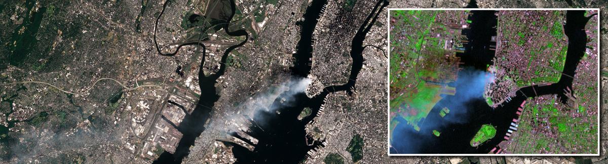
“Landsat 7 data have been pivotal in documenting environmental changes such as natural disasters, deforestation, and urban growth over its 25 years,” said David Applegate, USGS Director. “Notably capturing significant events like Hurricane Katrina in 2005, the Haiti earthquake in 2010, the Australian bushfires in 2019 - 2020, the dramatic growth of cities worldwide and more through its long-standing mission.”

The data have proven to be a useful asset as the foundation for countless studies, enhancing our understanding of agriculture, water resources, and wildland fires. By providing consistent data every eight days in conjunction with Landsat 5 until 2012, Landsat 7 improved our ability to monitor seasonal changes. Thanks to operational enhancements, Landsat 7 nearly doubled the daily data collected, from 250 to 450 scenes.
The Land Imaging Satellite that Could
When it was launched, Landsat 7 featured the Enhanced Thematic Mapper Plus (ETM+) sensor, which built upon and improved the capabilities of its predecessors, the Thematic Mapper (TM) sensor used on Landsat 4 and Landsat 5. As an eight-band, multispectral scanning radiometer, the ETM+ offered improvements over previous sensor technology including a 15-meter spatial resolution panchromatic band and 60-meter resolution thermal band.
However, four years after Landsat 7’s launch, a piece of equipment known as the Scan Line Corrector failed on the ETM+, impacting the satellite's ability to capture complete images of the Earth's surface. This led to “striping,” or gaps in its data. Despite the setback, 78 percent of a scene’s pixels are still usable and are considered some of the world’s most geometrically and radiometrically accurate civilian satellite data.

Landsat 7 went on to produce images for five times its expected operational lifespan.


To allow Landsat 9, launched in September 2021, to share the same orbital position as Landsat 8, the USGS lowered Landsat 7’s orbit. Even at its lower altitude, Landsat 7 continued to collect valuable data. However, being lowered caused Landsat 7 to increasingly drift within its orbit. The drift exposed it to periods of full sunlight and earlier imaging times, impacting battery maintenance, imaging opportunities, and processing of reliable science data. As a result, the USGS decided to end imaging from the aging satellite.

Today, Landsat operates with two satellites, Landsats 8 and 9, that work together to compile a complete set of Earth land images every 8 days.

The Landsat Mission Continues
With the end of Landsat 7’s role in the Landsat science mission and the advancing age of Landsat 8, launched in 2013, attention is now directed toward the Landsat Next mission as a critical next step to ensure continuity of Landsat’s unique global Earth science mission. The USGS is currently focused on ensuring the flow of data remains uninterrupted and that the quality of information keeps pace with evolving technological and environmental demands.
The newest mission, known as Landsat Next, promises enhanced capabilities over its predecessors, including improved spatial resolution, increased spectral bands, and faster revisit times. These advancements are essential for more detailed and frequent monitoring of Earth's changing landscapes and for supporting critical decisions in climate resiliency, disaster response, agriculture and water management.

Landsat Next is designed not only to continue the legacy of Landsat, but also to innovate and adapt to the pressing challenges of the 21st century, ensuring that scientists, policymakers, industry, and the public have access to the information needed to better monitor and sustainably manage our ever-changing planet.
Get Our News
These items are in the RSS feed format (Really Simple Syndication) based on categories such as topics, locations, and more. You can install and RSS reader browser extension, software, or use a third-party service to receive immediate news updates depending on the feed that you have added. If you click the feed links below, they may look strange because they are simply XML code. An RSS reader can easily read this code and push out a notification to you when something new is posted to our site.