
Satellite image of area around front of Kīlauea’s East Rift Zone lava flow
February 14, 2015
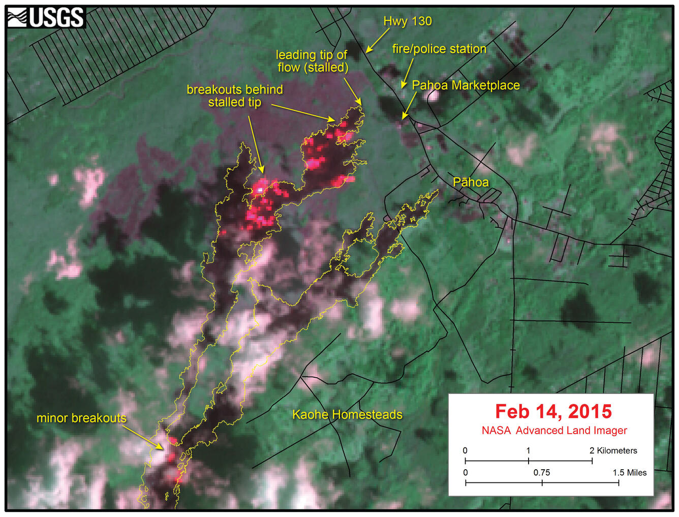
Sources/Usage: Public Domain. View Media Details
Citation Information
| Title | Satellite image of area around front of Kīlauea’s East Rift Zone lava flow |
|---|---|
| Record Source | USGS Publications Warehouse |