July 13, 2017—New map reveals geologic history: Mauna Loa Volcano's NE flank
January 1, 2018
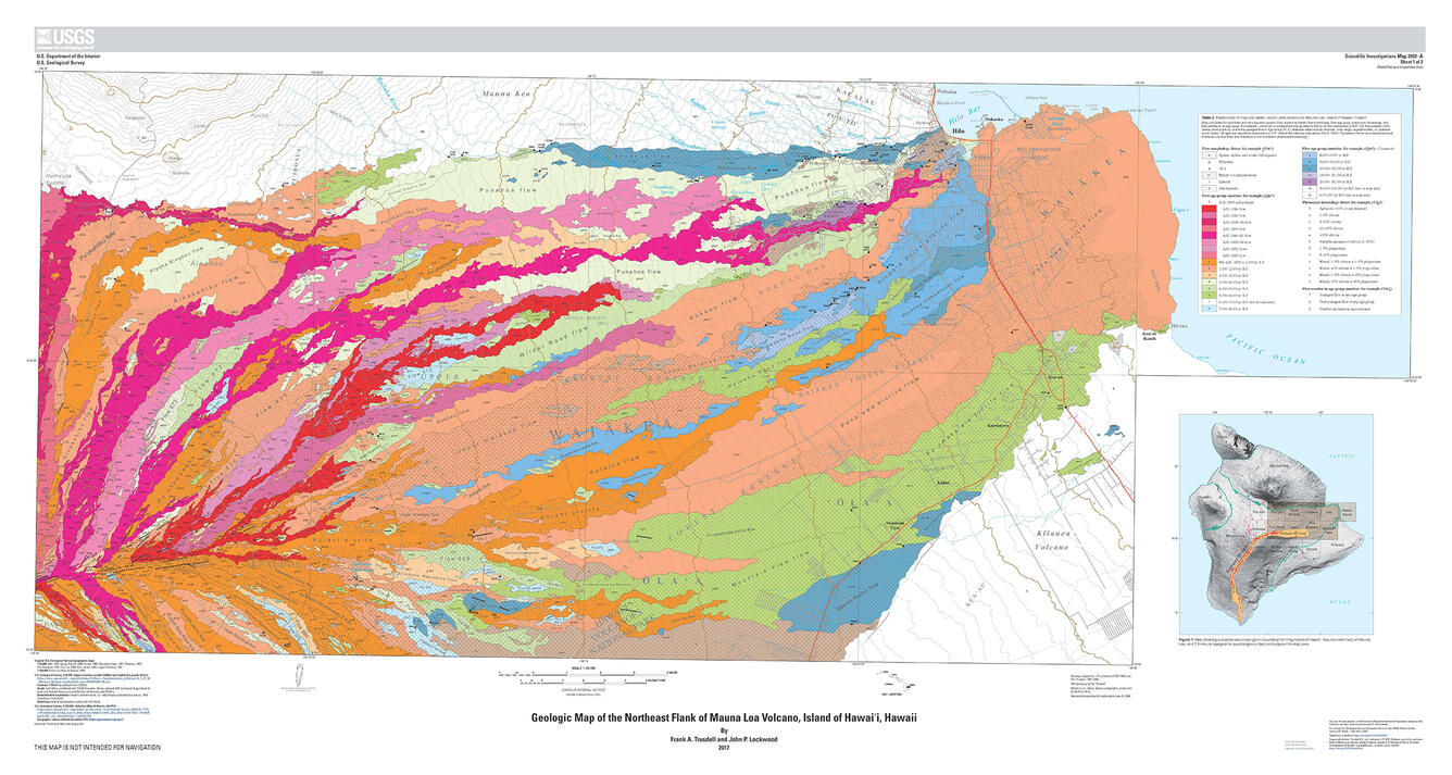
Sources/Usage: Public Domain. View Media Details

Official websites use .gov
A .gov website belongs to an official government organization in the United States.
Secure .gov websites use HTTPS
A lock () or https:// means you’ve safely connected to the .gov website. Share sensitive information only on official, secure websites.