U.S. flag

An official website of the United States government

September 28, 2022

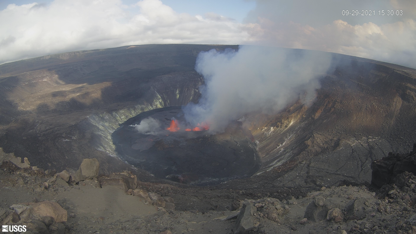
The eruption within Halema‘uma‘u, at Kīlauea's summit, began at approximately 3:20 p.m. one year ago today, on September 29, 2021. A series of photos and videos commemorate this milestone. 

HVO scientists collect detailed data to assess hazards and understand how the eruption is evolving at Kīlauea's summit, all of which are shared with the National Park Service and emergency managers. Access to this hazardous area is by permission from, and in coordination with, Hawai‘i Volcanoes National Park. 

Three-minute feature commemorating the eruption anniversary

Kīlauea volcano's summit eruption, within Hawai‘i Volcanoes National Park, began one year ago—on September 29, 2021. This three-minute video, produced by the Hawaiian Volcano Observatory, features footage from the past year and summarizes the eruption.

Audio-described version available here: https://www.usgs.gov/media/videos/september-29-2022-one-year-eruption-halemaumau-kilauea-ad


Images comparing the eruption just after it started to now

A comparison of KWcam images taken on September 28, 2021, before the eruption began in Halemaʻumaʻu on September 29, 2021, and on September 27, 2022.  On September 28, 2021, several islands, including the one in the center of the crater that formed on December 20, 2020, are surrounded by younger lava flows erupted during the December 2020-May 2021 Kīlauea summit eruption. On September 27, 2022, The floor of Halemaʻumaʻu has grown in area and elevation due to the ongoing eruption in crater. The island that formed on December 20, 2020, is surrounded by younger lava flows so what is seen on the surface of Halemaʻumaʻu crater floor represents the oldest and youngest deposits from these recent eruptions! USGS photos.
The USGS Hawaiian Volcano Observatory KWcam at Kīlauea's summit has captured changes within Halemaʻumaʻu crater, at Kīlauea's summit, over the past year. At approximately 3:21 pm, HST, on September 29, 2021, new fissures opened at the base of Halemaʻumaʻu crater. Since then, the crater floor has continued to rise in elevation and grow in area as the eruption continues. The first image was taken on September 29, 2021, just after the eruption began; the second image was taken the morning of September 29, 2022, and shows the changes over the past year. Near-real-time images captured by the KWcam are available here: /volcanoes/kilauea/kwcam-live-panorama-halema-uma-u-.... USGS webcam images. 

Halema‘uma‘u crater floor rise over the past several months

This timelapse sequence shows one image per day since March from the B1cam webcam on the east rim of Halema‘uma‘u, at the summit of Kīlauea. The images show that the floor of Halema‘uma‘u has been growing endogenously. Lava is supplied beneath the solidified crust that forms the surface of the crater floor, lifting the surface in a manner similar to inflating an air mattress. In addition to endogenous growth, sporadic lava flows overplate the crust and also contribute to growth.

Animated GIFs showing changes over the past year

Animated gif of eruption maps
This animated gif shows one year of reference maps depicting the ongoing Kīlauea summit eruption, which began on September 29, 2021. The animated gif shows how the active lava lake has decreased in area over the past year, while the crater floor has grown in area. As of September 29, 2022, one eruptive vent (orange) is active within Halema‘uma‘u, on the western side of the crater floor. An adjacent pond (purple) is feeding lava to a larger lake (red) via a crusted-over tube. Visit the park eruption page for more info: https://www.nps.gov/havo/learn/nature/september-2021-eruption.htm
Animated gif of eruption maps
This animated gif shows one year of thermal maps made from aerial visual and thermal imagery collected of Halema‘uma‘u crater at the summit of Kīlauea. The animated gif shows how the active lava lake has decreased in area over the past year, while the crater floor has grown in area. As of September 29, 2022, the active lake surface is limited to the western portion of the crater. The scale of the thermal map ranges from blue to red, with blue colors indicative of cooler temperatures and red colors indicative of warmer temperatures.


Kīlauea Volcano crater filling as of September 2022

Color map of eruption at summit of volcano
This map of the Kīlauea summit is mostly identical to the September 13, 2022, eruption reference map, but also included here are west to east topographic profiles across the caldera. Profiles are provided for the periods before the 2018 caldera collapse (orange), shortly after the 2018 collapse (black), from mid-2021 depicting the December 2020–May 2021 eruption (red), and from this month depicting the September 2021–present eruption (pink). Also shown is the maximum depth of the 2019–20 Halema‘uma‘u water lake (blue). Elevations are expressed in meters above sea level (m asl).

Selection of Halema‘uma‘u eruption photos taken over the past year

Get Our News

These items are in the RSS feed format (Really Simple Syndication) based on categories such as topics, locations, and more. You can install and RSS reader browser extension, software, or use a third-party service to receive immediate news updates depending on the feed that you have added. If you click the feed links below, they may look strange because they are simply XML code. An RSS reader can easily read this code and push out a notification to you when something new is posted to our site.