
Adjuntas, Puerto Rico Landslide Monitoring Station
Active
By Landslide Hazards Program
February 2, 2023
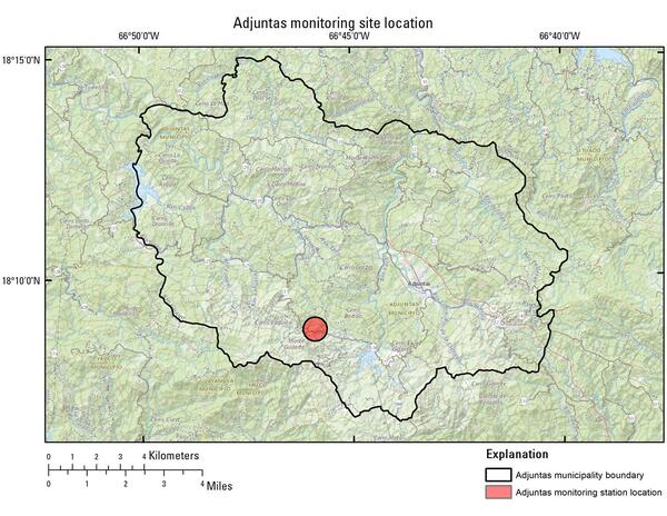
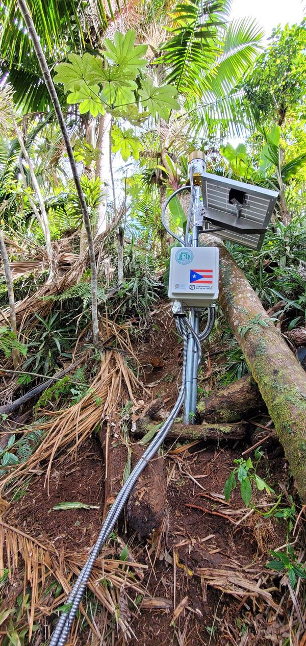
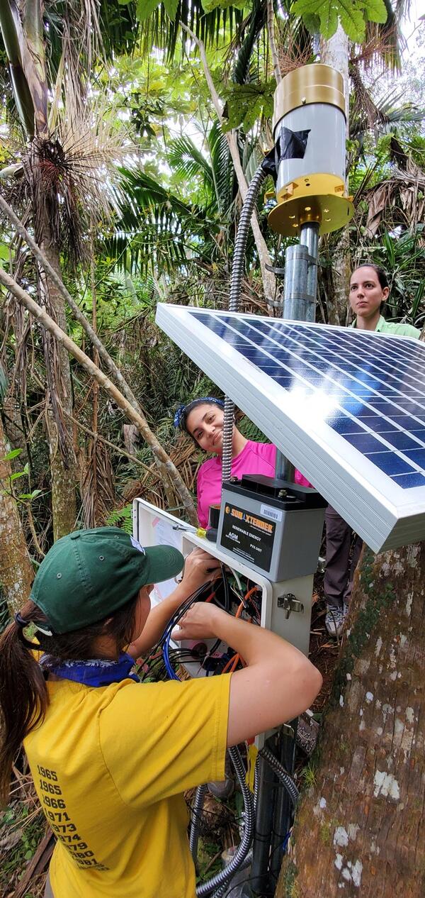
The Adjuntas monitoring station is situated at a relatively high elevation area with steep slopes under thick vegetation. The station is underlain by Tertiary-Cretaceous volcanic rock.
Sources/Usage: Public Domain. View Media Details
Sources/Usage: Public Domain. View Media Details
Sources/Usage: Public Domain. View Media Details
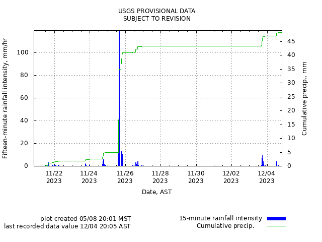
Rainfall | Soil Water Content, Soil Suction, and Ground Water Pressure | Battery Voltage
Rainfall
Remote image Url
Sources/Usage: Public Domain. View Media Details
Soil-Water Content, Soil Suction, and Ground Water Pressure
Remote image Url
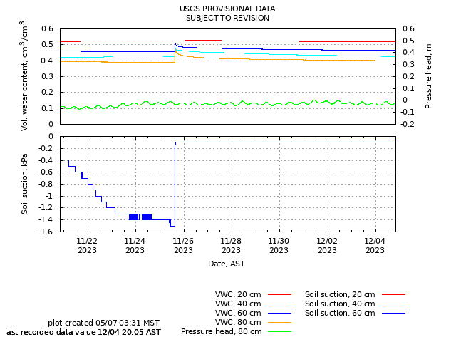
Sources/Usage: Public Domain. View Media Details
Battery Voltage
Remote image Url
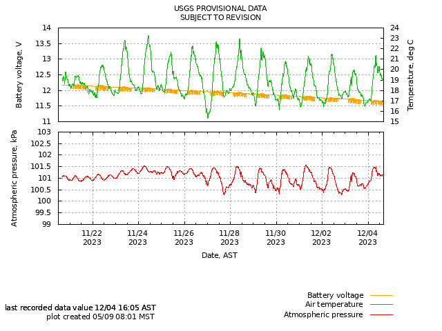
Sources/Usage: Public Domain. View Media Details

Puerto Rico Landslide Monitoring Network
The USGS and the University of Puerto Rico-Mayagüez installed instruments to monitor hillslope hydrological conditions in fifteen municipalities in mountainous regions across Puerto Rico.
The Adjuntas monitoring station is situated at a relatively high elevation area with steep slopes under thick vegetation. The station is underlain by Tertiary-Cretaceous volcanic rock.
Sources/Usage: Public Domain. View Media Details
Sources/Usage: Public Domain. View Media Details
Sources/Usage: Public Domain. View Media Details
Rainfall | Soil Water Content, Soil Suction, and Ground Water Pressure | Battery Voltage
Rainfall
Remote image Url
Sources/Usage: Public Domain. View Media Details
Soil-Water Content, Soil Suction, and Ground Water Pressure
Remote image Url
Sources/Usage: Public Domain. View Media Details
Battery Voltage
Remote image Url
Sources/Usage: Public Domain. View Media Details
Puerto Rico Landslide Monitoring Network
The USGS and the University of Puerto Rico-Mayagüez installed instruments to monitor hillslope hydrological conditions in fifteen municipalities in mountainous regions across Puerto Rico.