
Añasco, Puerto Rico Landslide Monitoring Station
Active
By Landslide Hazards Program
November 15, 2023
The Añasco monitoring station is located in the eastern part of the coastal Añasco municipality. The station is located in a highly vegetated area underlain by the Lago Garzas Formation. A fence was built around the enclosure to deter grazing cows on the hillslope.

Sources/Usage: Public Domain. View Media Details

Sources/Usage: Public Domain. View Media Details

Sources/Usage: Public Domain. View Media Details

Sources/Usage: Public Domain. View Media Details
Rainfall
Remote image Url
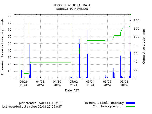
Sources/Usage: Public Domain. View Media Details
Soil-Water Content, Soil Suction, and Ground Water Pressure
Remote image Url
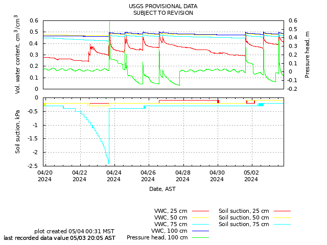
Sources/Usage: Public Domain. View Media Details
Battery Voltage, Air Temperature, and Atmospheric Pressure
Remote image Url
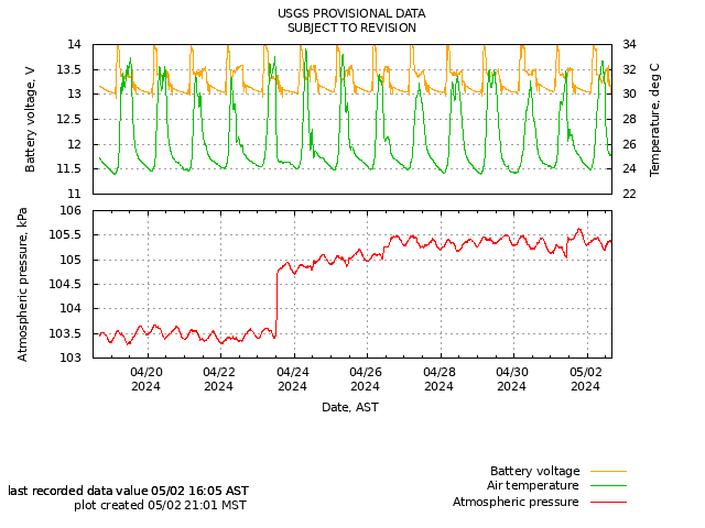
Sources/Usage: Public Domain. View Media Details
The Añasco monitoring station is located in the eastern part of the coastal Añasco municipality. The station is located in a highly vegetated area underlain by the Lago Garzas Formation. A fence was built around the enclosure to deter grazing cows on the hillslope.
Sources/Usage: Public Domain. View Media Details
Sources/Usage: Public Domain. View Media Details
Sources/Usage: Public Domain. View Media Details
Sources/Usage: Public Domain. View Media Details
Rainfall
Remote image Url
Sources/Usage: Public Domain. View Media Details
Soil-Water Content, Soil Suction, and Ground Water Pressure
Remote image Url
Sources/Usage: Public Domain. View Media Details
Battery Voltage, Air Temperature, and Atmospheric Pressure
Remote image Url
Sources/Usage: Public Domain. View Media Details