
Naranjito, Puerto Rico Landslide Monitoring Station
Active
By Landslide Hazards Program
February 14, 2023
The Naranjito monitoring site is also in a heavily vegetated area underlain by Cretaceous volcaniclastic rock.

Sources/Usage: Public Domain. View Media Details

Sources/Usage: Public Domain. View Media Details

Sources/Usage: Public Domain. View Media Details
Rainfall | Soil Water Content, Soil Suction, and Ground Water Pressure | Battery Voltage
Rainfall
Remote image Url
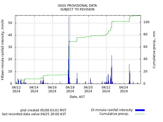
Sources/Usage: Public Domain. View Media Details
Soil-Water Content, Soil Suction, and Ground Water Pressure
Remote image Url
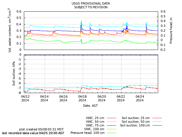
Sources/Usage: Public Domain. View Media Details
Battery Voltage
Remote image Url
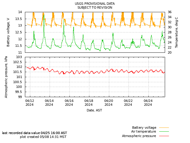
Sources/Usage: Public Domain. View Media Details
The Naranjito monitoring site is also in a heavily vegetated area underlain by Cretaceous volcaniclastic rock.
Sources/Usage: Public Domain. View Media Details
Sources/Usage: Public Domain. View Media Details
Sources/Usage: Public Domain. View Media Details
Rainfall | Soil Water Content, Soil Suction, and Ground Water Pressure | Battery Voltage
Rainfall
Remote image Url
Sources/Usage: Public Domain. View Media Details
Soil-Water Content, Soil Suction, and Ground Water Pressure
Remote image Url
Sources/Usage: Public Domain. View Media Details
Battery Voltage
Remote image Url
Sources/Usage: Public Domain. View Media Details