
Yauco, Puerto Rico Landslide Monitoring Station
Active
By Landslide Hazards Program
September 19, 2023
The Yauco monitoring station is located in the northern portion of the Yauco municipality, near the Yacuo-Maricao municipalities boundary. Landslide susceptibility is classified as very high at this site, which is underlain by Yauco Mudstone on a very steep slope in a heavily vegetated area.

Sources/Usage: Public Domain. View Media Details

Sources/Usage: Public Domain. View Media Details
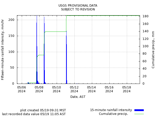
Rainfall
Remote image Url
Sources/Usage: Public Domain. View Media Details
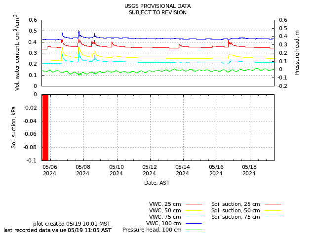
Soil-Water Content, Soil Suction, and Ground Water Pressure
Remote image Url
Sources/Usage: Public Domain. View Media Details
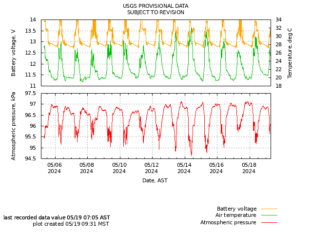
Battery Voltage, Air Temperature, and Atmospheric Pressure
Remote image Url
Sources/Usage: Public Domain. View Media Details
The Yauco monitoring station is located in the northern portion of the Yauco municipality, near the Yacuo-Maricao municipalities boundary. Landslide susceptibility is classified as very high at this site, which is underlain by Yauco Mudstone on a very steep slope in a heavily vegetated area.
Sources/Usage: Public Domain. View Media Details
Sources/Usage: Public Domain. View Media Details
Rainfall
Remote image Url
Sources/Usage: Public Domain. View Media Details
Soil-Water Content, Soil Suction, and Ground Water Pressure
Remote image Url
Sources/Usage: Public Domain. View Media Details
Battery Voltage, Air Temperature, and Atmospheric Pressure
Remote image Url
Sources/Usage: Public Domain. View Media Details