
Evaluation of the Effects of Development on Peak-Flow Hydrographs for Collyer Brook, Maine
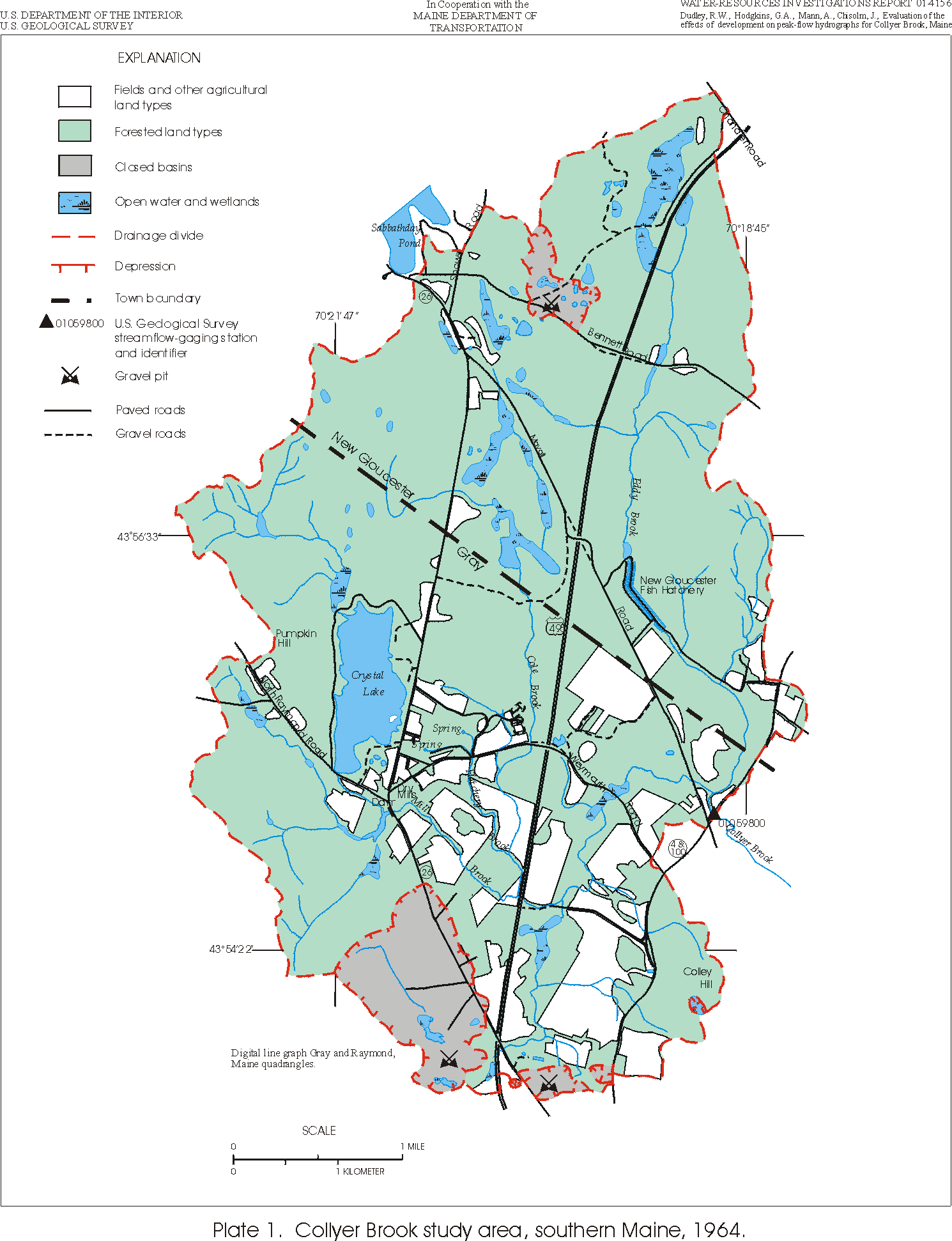
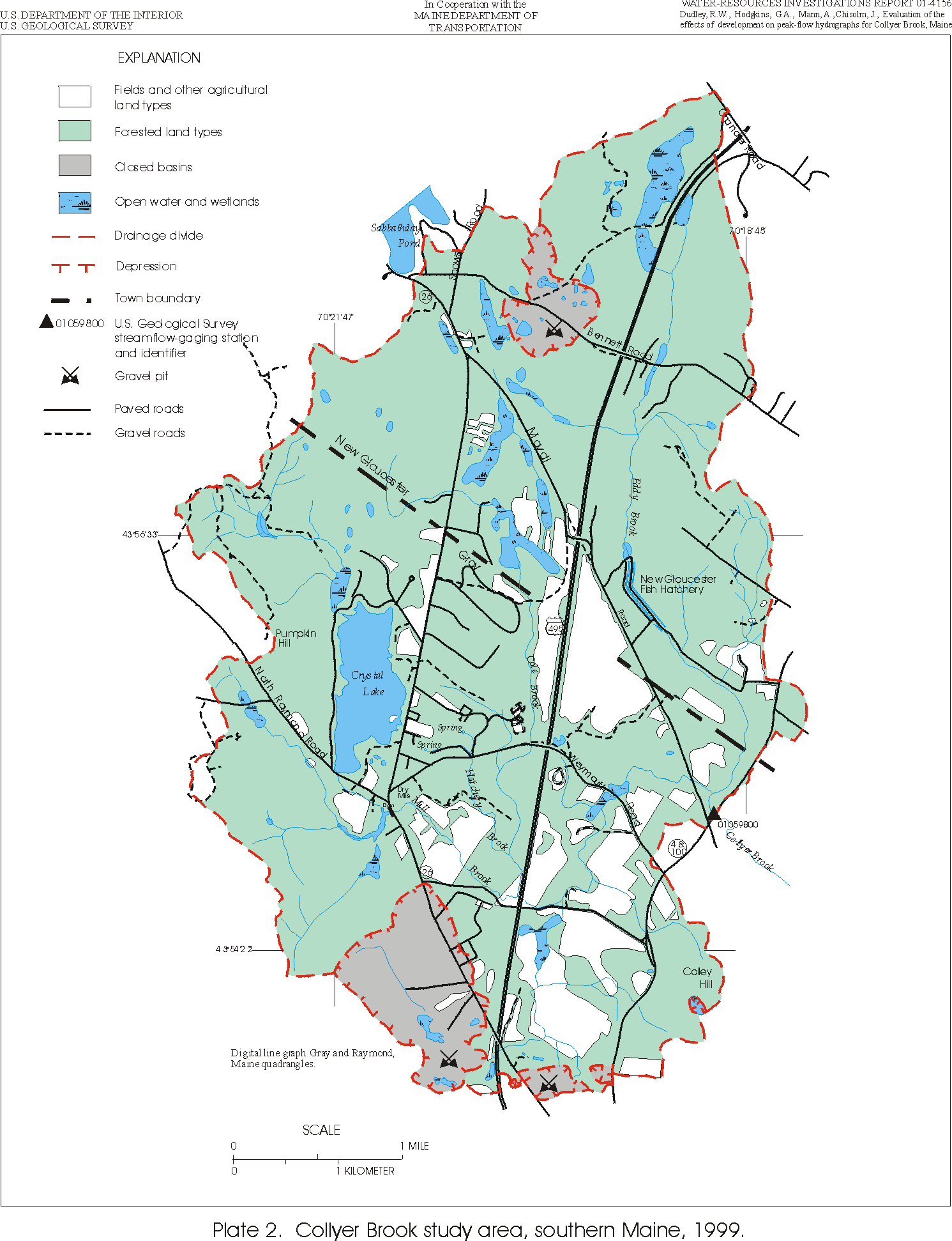
The development of former agricultural or forested lands creates more impervious areas and drainage improvements that can increase the volume of runoff and decrease infiltration and ground-water recharge in a watershed. Drainage improvements also can improve the conveyance of runoff, decreasing the time of rise to peak flow between the start of a rainfall event and the peak surface-water runoff, and likewise decreasing the duration of the peak-flow event. The watershed of Collyer Brook in southern Maine was studied to evaluate the effect of land-use changes on peakflow hydrographs because of the known development in the area during the past 35 years and the availability of aerial photos and streamflow data for this time period.
Although aerial photography indicates that suburban development has increased in the watershed between 1964 and 1999, the overall effect of suburbanization on rainfall-runoff processes in the watershed did not produce a statistically detectable change in the peak-flow hydrographs for Collyer Brook.
Citation Information
| Publication Year | 2001 |
|---|---|
| Title | Evaluation of the Effects of Development on Peak-Flow Hydrographs for Collyer Brook, Maine |
| DOI | 10.3133/wri20014156 |
| Authors | Robert W. Dudley, Glenn A. Hodgkins, Alexander Mann, John Chisolm |
| Publication Type | Report |
| Publication Subtype | USGS Numbered Series |
| Series Title | Water-Resources Investigations Report |
| Series Number | 2001-4156 |
| Index ID | wri20014156 |
| Record Source | USGS Publications Warehouse |
| USGS Organization | Maine Water Science Center |