
StreamStats Data Refresh
Did you know the underlying data and functionality of StreamStats varies by state?
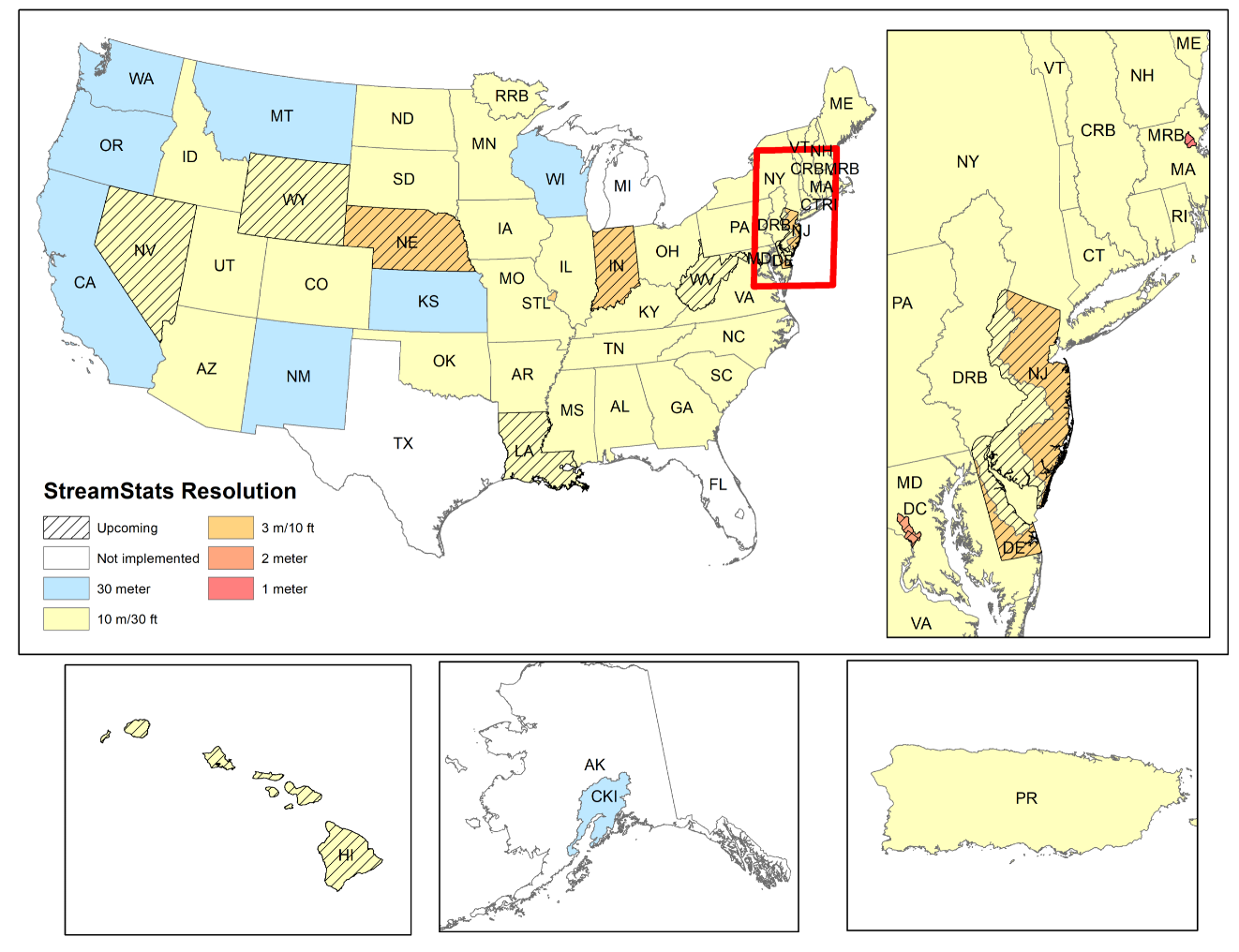
StreamStats applications are developed by USGS Water Science Center scientists in cooperation with federal, state, and local agencies. The data, methods, and functionality varies from state to state based on availability of data, when the project was developed, and the funding available to develop the application. In recent years many cooperators have approached the USGS Water Science Centers with requests to refresh the digital elevation data and StreamStats delineation capability using lidar derived digital elevation models. South Carolina, North Carolina, and Pennsylvania have all completed refreshes of the underlying data. Delaware, New Jersey, and Indiana have refreshes in process. Five additional states (Nevada, Wyoming, Nebraska, Louisiana, and West Virginia) are all actively developing new StreamStats applications at differing resolution.
If you're interested in being a cooperator to improve the underlying data for StreamStats applications or develop an application in your state please reach out to your local USGS Water Science Center.
Get Our News
These items are in the RSS feed format (Really Simple Syndication) based on categories such as topics, locations, and more. You can install and RSS reader browser extension, software, or use a third-party service to receive immediate news updates depending on the feed that you have added. If you click the feed links below, they may look strange because they are simply XML code. An RSS reader can easily read this code and push out a notification to you when something new is posted to our site.