An official website of the United States government
Here's how you know
Official websites use .gov
A .gov website belongs to an official government organization in the United States.
Secure .gov websites use HTTPS
A lock () or https:// means you’ve safely connected to the .gov website. Share sensitive information only on official, secure websites.
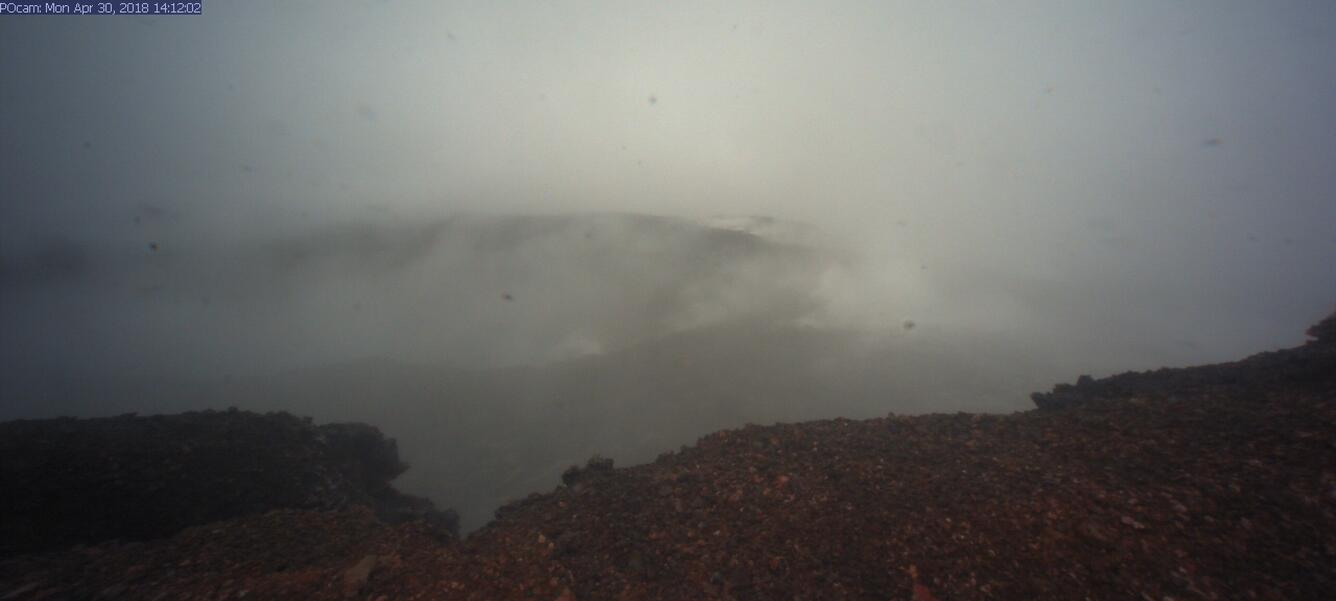
Starting at about 2:00 p.m. on Monday, April 30, marked increased seismicity and ground deformation indicated that the expected change at Pu‘u ‘Ō‘ō was underway. Visibility was nearly obscured due to poor weather conditions, but a brief clearing at 2:12 allowed HVO's webcam to capture this image of the crater, showing that part of the crater floor within Pu‘u ‘Ō‘ō on Kīlauea Volcano's East Rift Zone had collapsed. The crater floor continued to collapse for several hours therafter; smaller drops in the crater floor have likely continued through today (May 1).
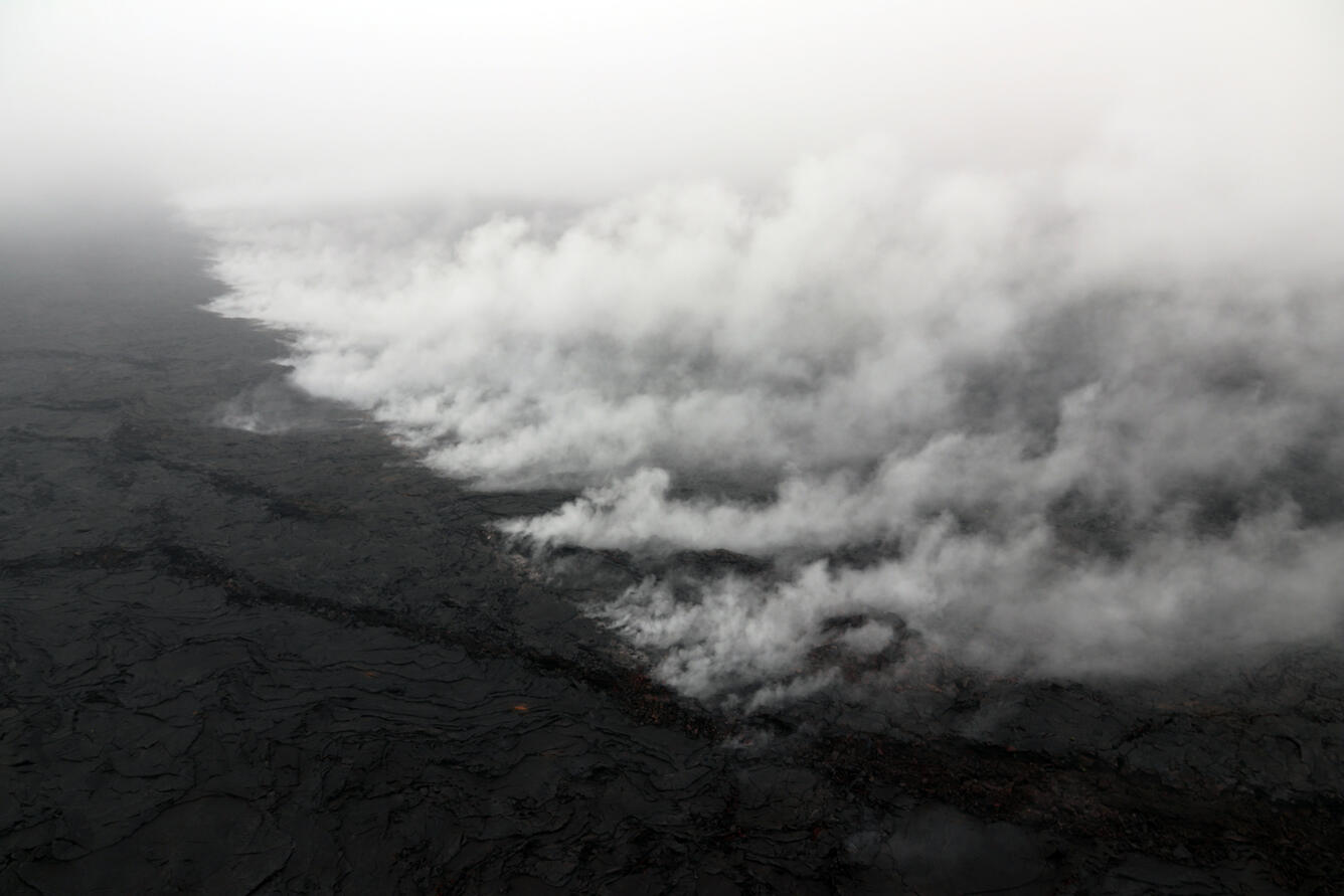
A new crack 1 km (0.6 mile) long was found during today's overflight on the west (uprift) side of Pu‘u ‘Ō‘ō. The cracking appeared to be nearly continuous en echelon structures, that were heavily steaming. A small amount of lava was erupted from the crack in the form of tiny pads of lava and spatter, and was no longer active this morning during the overflight. This photo is looking east, and Pu‘u ‘Ō‘ō is obscured by low clouds in the upper left corner.
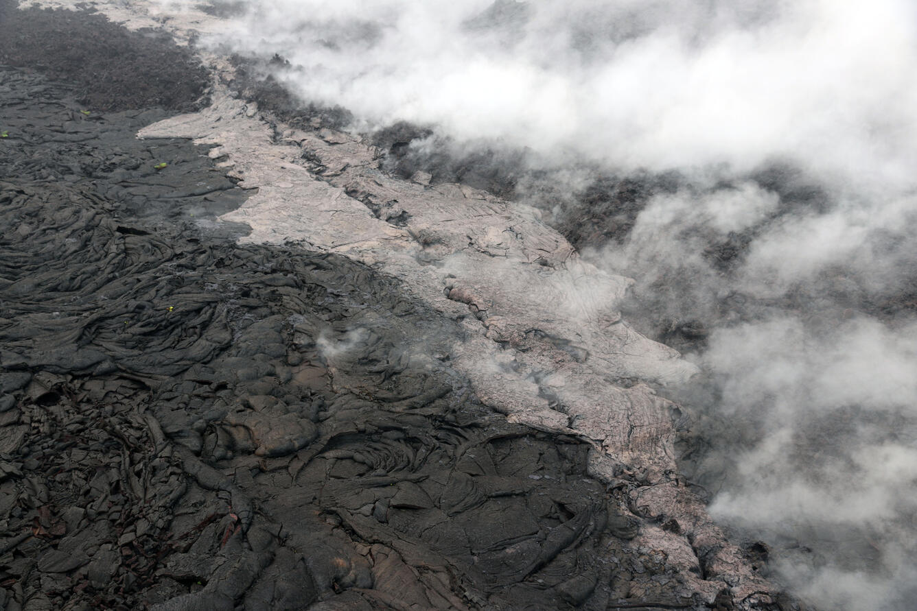
Telephoto view of a small lava flow (lighter in color) and spatter (blue-gray) that were erupted from a section of the crack on the west flank of Pu‘u ‘Ō‘ō.
The collapse of Pu‘u ‘Ō‘ō's crater floor yesterday produced a large amount of red ash that was deposited around Pu‘u ‘Ō‘ō, and a thin layer continued uprift to Mauna Ulu. This photo, taken between 1-2 km (0.6-1.2 miles) from the 61g vent, shows a layer of red ash on top of the 61g flow active surface breakouts.
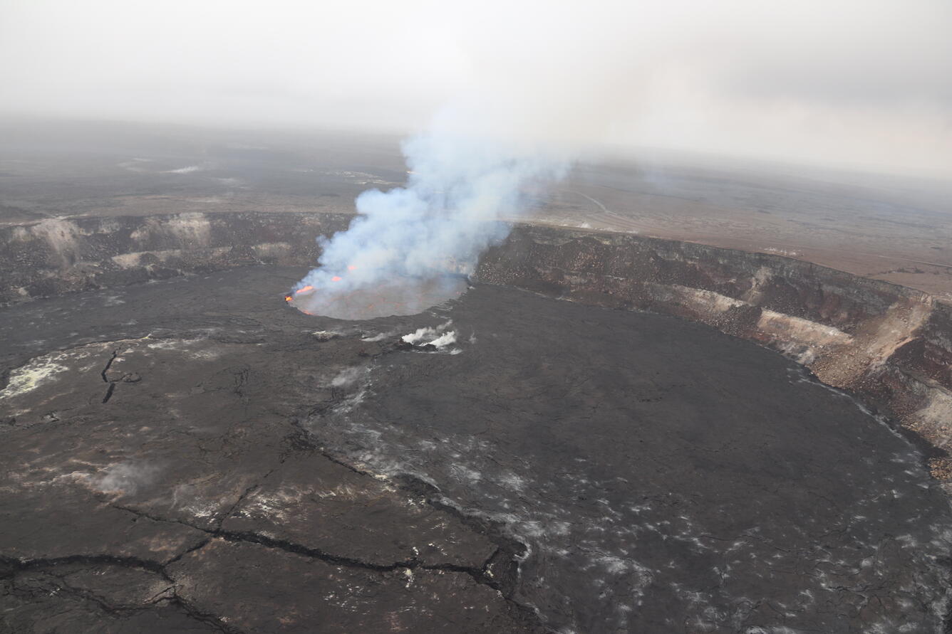
As of this afternoon (May 1), the eruption at the summit of Kīlauea has apparently not been affected by the collapse of Pu‘u ‘Ō‘ō or intrusion of magma along the volcano's Lower East Rift Zone. Following multiple overflows of the summit lava lake on April 21-27, which spilled lava onto the floor of Halema‘uma‘u, the lava lake level dropped over the weekend (April 28-29). But on the morning of April 30, the lava lake level began to rise in concert with summit inflation. This image of the summit lava lake was taken during HVO's overflight just before 8:00 a.m. today.
Just before 10:00 a.m. today (Monday, April 30), a break in the weather allowed HVO's webcam to capture this image of the lava lake within Halema‘uma‘u at the summit of Kīlauea. Following multiple overflows of the lava lake last week, the lake level dropped over the weekend in concert with the switch to summit deflation. Early this morning, the lava lake level was estimated to be about 15 m (49 feet) below the vent rim, but shortly thereafter, the summit switched to inflation, so the lake level could rise in the coming hours/days.
Get Our News
These items are in the RSS feed format (Really Simple Syndication) based on categories such as topics, locations, and more. You can install and RSS reader browser extension, software, or use a third-party service to receive immediate news updates depending on the feed that you have added. If you click the feed links below, they may look strange because they are simply XML code. An RSS reader can easily read this code and push out a notification to you when something new is posted to our site.