An official website of the United States government
Here's how you know
Official websites use .gov
A .gov website belongs to an official government organization in the United States.
Secure .gov websites use HTTPS
A lock () or https:// means you’ve safely connected to the .gov website. Share sensitive information only on official, secure websites.
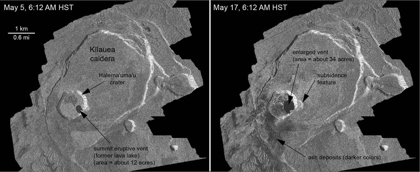
These radar amplitude images were acquired by the Italian Space Agency's Cosmo-SkyMed satellite system and show changes to the caldera area of Kīlauea Volcano that occurred between May 5 at 6:12 a.m. HST (left) and May 17 at 6:12 a.m. HST (right). The satellite transmits a radar signal at the surface and measures the strength of the reflection, with bright areas indicating a strong reflection and dark areas a weak reflection. Strong reflections indicate rough surfaces or slopes that point back at the radar, while weak reflections come from smooth surfaces or slopes angled away from the radar.The May 17 image was acquired after two small explosions from the summit eruptive vent. Major changes with respect to the May 5 image include: (1) a darkening of the terrain south of Halema‘uma‘u, which may reflect accumulation of ash over the 12-day period between the images; (2) enlargement of the summit eruptive vent on the floor of Halema‘uma‘u, from about 12 acres on May 5 to about 34 acres on May 17; and (3) the development of a small depression (area of about 15 acres) on the east rim of Halema‘uma‘u that reflects slumping of a portion of the rim towards the growing collapse pit on the crater floor.
Fissure activity increases overnight in lower East Rift Zone, Kīlauea Volcano
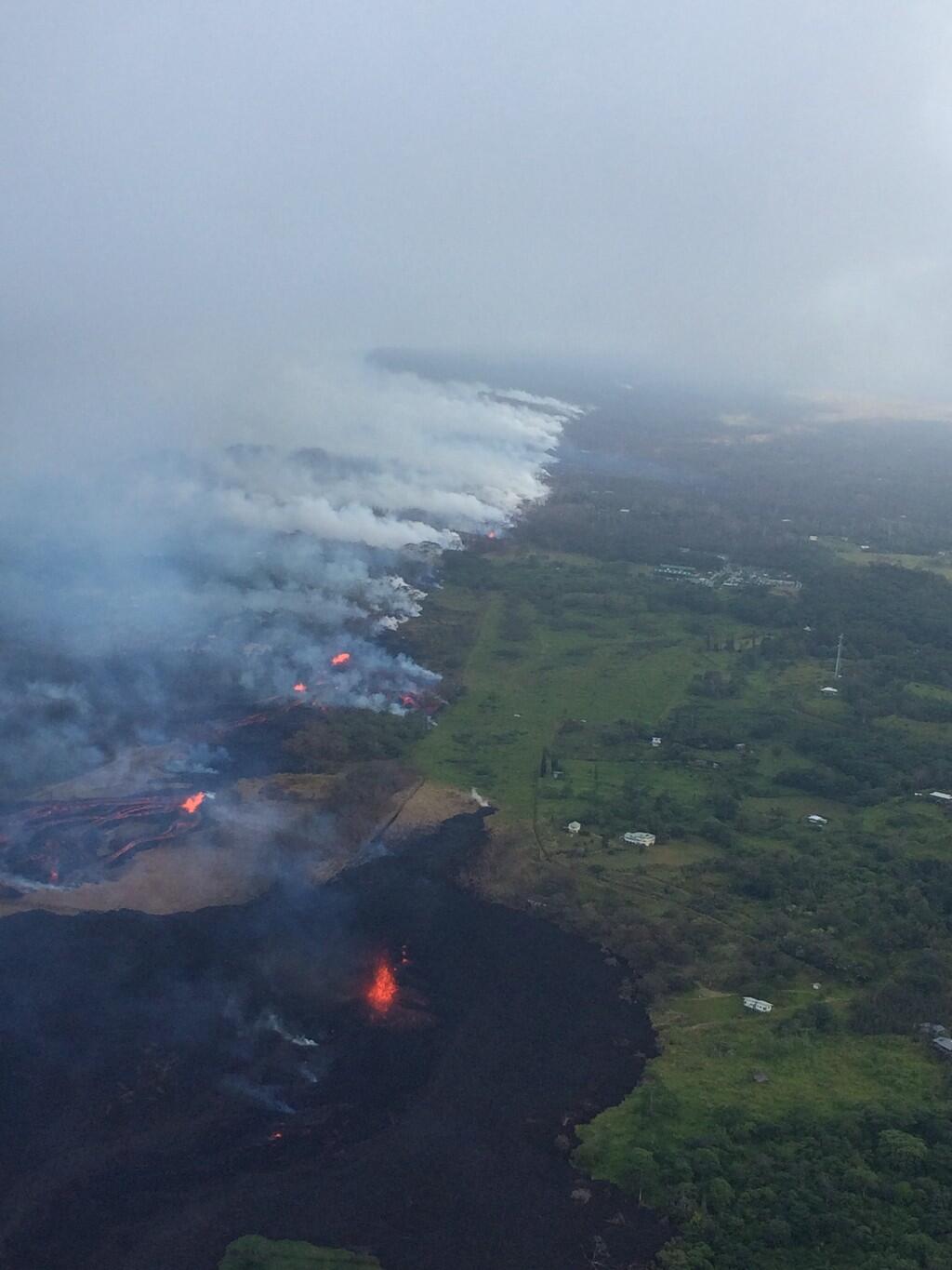
Aerial view of the lowermost section of the active fissure system during an overflight early this morning. The view is looking toward the south; note ocean at top of photo. Fissure 17 is the on the left-hand side of photo; fissure 18 is in the middle; and fissure 20 are the two low fountaining areas in the middle right of photo.
Closer view of fissure 17 (middle photo) and fissure 18 (left side photo) during this morning's overflight of the area. View is toward the south.
View of the fissure system in Leilani Estates looking southwest (uprift). Fissure 17 is the lava fountain at bottom of photo, estimated to be about 50 m (164 ft) high with occasional bursts to about 100 m high (328 ft). Fissure 18 is the low fountain left of center feeding a lava flow that spreads out of view on left (south). Fissure 20 is in middle of photo, also feeding a lava flow. Note activity further uprift of fissure 20 (field reports suggest that this is fissure 15).
This morning, the line of fountains on fissure 17 coalesced into a large fountain that was sending lava 50 meters (164 feet) into the air, with small bits of spatter thrown up to 100 meters (328 feet) high. At about 12:00 p.m. HST, HVO geologists flying over the area reported that fissure 17 was going strong.
This image, captured during an HVO overflight around noon today, shows a lava flow that crossed Pohoiki Road earlier.
As of today the Pohoiki water line was covered by lava from fissure 15.
Get Our News
These items are in the RSS feed format (Really Simple Syndication) based on categories such as topics, locations, and more. You can install and RSS reader browser extension, software, or use a third-party service to receive immediate news updates depending on the feed that you have added. If you click the feed links below, they may look strange because they are simply XML code. An RSS reader can easily read this code and push out a notification to you when something new is posted to our site.