U.S. flag

An official website of the United States government

Photo and Video Chronology – Kīlauea – November 2, 2021

November 2, 2021

The ongoing eruption at Kīlauea's summit began at 3:21 p.m. HST on September 29, 2021. Lava activity is currently confined within Halema'uma'u crater. Gas emissions and seismic activity at the summit remain elevated. HVO field crews—equipped with specialized safety gear—monitor the eruption from within the closed area of Hawai‘i Volc

HVO scientists collect detailed data to assess hazards and understand how the eruption is evolving at Kīlauea's summit, all of which are shared with the National Park Service and emergency managers. Access to this hazardous area is by permission from, and in coordination with, Hawai‘i Volcanoes National Park.

Kīlauea summit—November 1, 2021

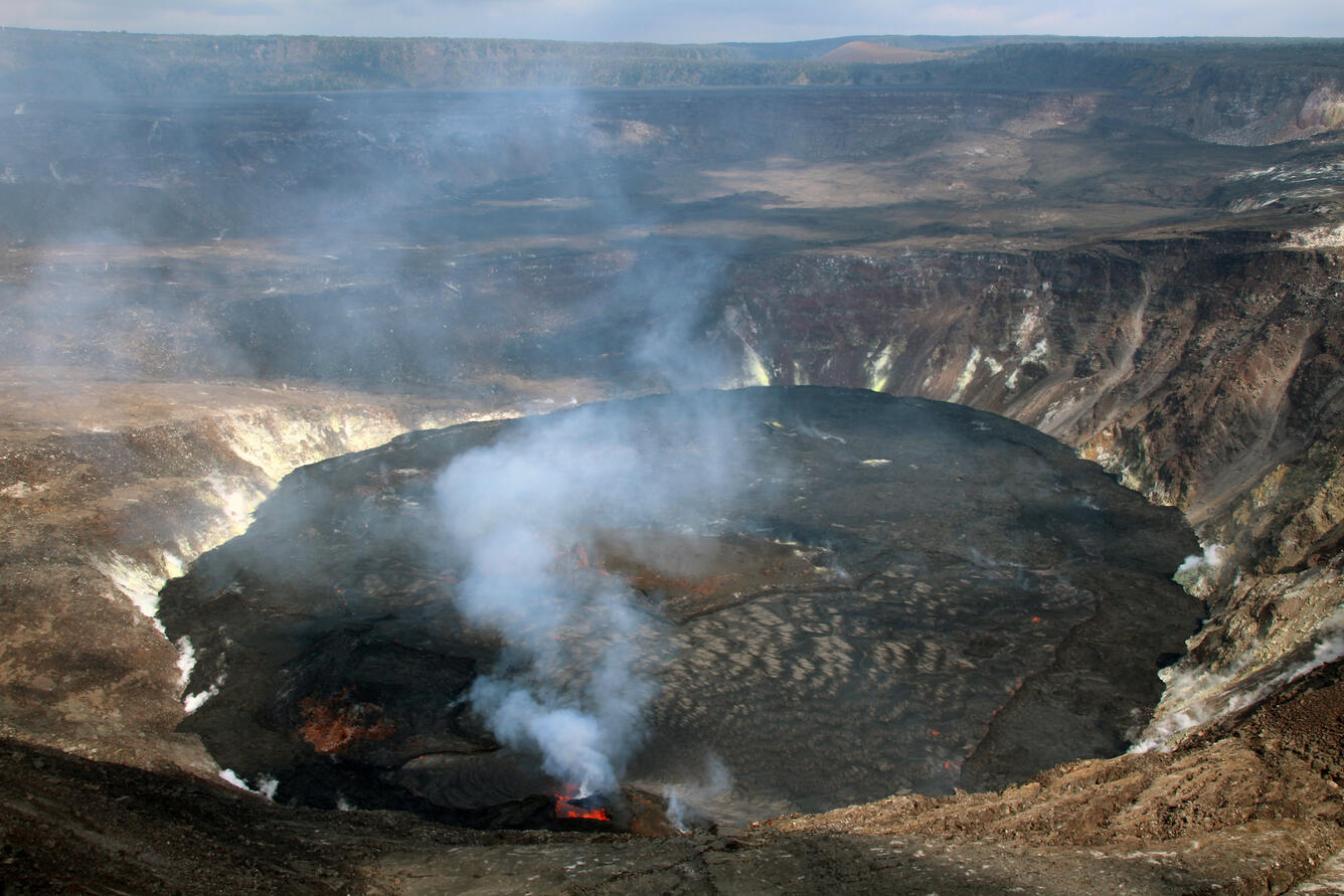
A wide view of a lava lake with a crater wall vent producing a white volcanic gas plume
A wide view of the lava lake in Halema‘uma‘u, at the summit of Kīlauea, on November 1, 2021. This view, looking east, shows the west vent (bottom center) which continues to supply lava to the active portion of the lava lake, while the eastern portion (far side of lake) is crusted over. The active lake is primarily between the west vent source and the main island (center) and has a silver-gray appearance in this photo. The northeastern end of the lava lake has now risen high enough to start covering the lowest portion of the down-dropped block on the north side of Halema‘uma‘u (center left), formed during the 2018 Kīlauea caldera collapse. USGS photo by N. Deligne.
A telephoto color image of dark stagnant lava lake surface crust along the margin, with older crater wall at the edge
A telephoto image of the northeast margin of the lava lake within Halema‘uma‘u, at Kīlauea summit, on November 1, 2021. The lava lake has now risen high enough to start covering the lowest portion of the down-dropped block on the north side of Halema‘uma‘u. Lava is just starting to cover a small area—immediately south (right) of a fumarole (white steam and yellow sulfur patch)—close to the northeastern lake margin (center left). USGS photo by N. Deligne.
Four sequential images of a small lava fountain within a dark spatter cone, taken seconds apart
A sequence of telephoto images of the west vent (spanning 4 seconds), within Halema‘uma‘u at Kīlauea summit. The west vent continues to produce low-level lava fountains (seen here), which are forming an elevated pond of lava within the spatter cone. The pond then supplies lava to the lava lake through a small spillway that is obscured here by the volcanic gas plume. USGS photos taken on November 1, 2021, by N. Deligne.

Get Our News

These items are in the RSS feed format (Really Simple Syndication) based on categories such as topics, locations, and more. You can install and RSS reader browser extension, software, or use a third-party service to receive immediate news updates depending on the feed that you have added. If you click the feed links below, they may look strange because they are simply XML code. An RSS reader can easily read this code and push out a notification to you when something new is posted to our site.