
3D Nation
3D Nation
Making the U.S. Economy More Competitive in the 21st Century by Building a Modern, Accurate Elevation Foundation from our Highest Mountains to Our Deepest Oceans
Building a modern elevation foundation – from the peaks of our mountains to the depths of our waters – for stronger, more resilient communities and U.S. economy
3D Nation: Why
Critical decisions are made across our Nation every day that depend on elevation data, ranging from immediate safety of life and property to long term planning for infrastructure projects. The quality and timeliness of these decisions depends upon actionable information supported by accurate elevation data.
To be competitive in the 21st century, our Nation must be GPS-enabled and ready with three-dimensional (3D) maps to capitalize on all that GPS positioning accuracies offer. The United States is GPS-enabled but lacks a comprehensive, accurate 3D foundation. We need maps and elevation data accurate to centimeters rather than hundreds of meters.
National imagery, parcels, transportation, structures and other geospatial data must be accurate; they are only as good as the foundation they are built on. We need quality geodetic control across the nation, and a robust, coordinated approach to mapping our lands and waters in an accurate and timely way. We won’t fully realize the benefits of geographic precision until U.S. map data have a solid 3D foundation – until we are a 3D Nation.
3D Nation: What
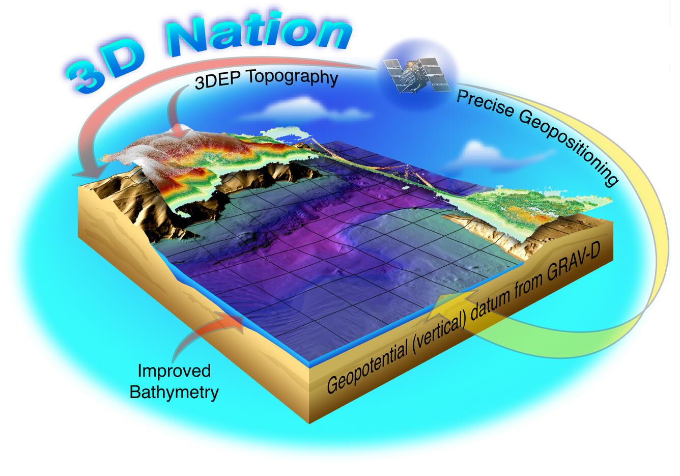
An accurate 3D foundation depends on improvements to the geodetic control network and to the foundational topographic and bathymetric datasets managed by NOAA and the USGS as the Nation’s leading agency elevation data stewards. The 3D Nation initiative is beginning to provide the most accurate foundation for mapping our changing world. The goal of 3D Nation is to ensure access to an accurate, routinely updated, continuous elevation surface from the peaks of our mountains to the depths of our waters. Based upon past evaluations of the benefits of elevation data to society, an expanded 3D Nation capability will reap significant returns for a broad set of applications and user groups.
3D Nation: How
Working with our partners, USGS and NOAA are leading improvement of the national mapping foundation, making incremental advances within current resources by coordinating the topographic mapping contributions of the USGS 3D Elevation Program (3DEP) and the 3D Hydrography Program (3DHP), NOAA’s GRAV-D program, and the coastal topographic and bathymetric mapping activities of NOAA, USGS, FEMA, USACE and other Federal and state elevation activities. The concept of 3D Nation serves as a unifying goal for all these efforts, providing a consistent set of standards and objectives of an authoritative National geospatial foundation to support national mapping needs.
The 3D Nation Elevation Subcommittee of the Federal Geographic Data Committee (FGDC) is a forum for coordination as shown in the figure below.
