The U.S. Geological Survey provides critical information to help protect communities from the natural hazards that occur every day. As the preeminent hazard science agency, we monitor everything from earthquakes to volcanoes, from landslides to flooding, and so much more. Our science is used by emergency responders and policymakers to support public safety, security, and economic well-being.
Natural Hazards We Might Face
Natural hazards are unavoidable. But with proper preparedness, their impact can be reduced. The USGS and its partners work to prepare, monitor, assess, and alert people to the hazards around them. Are you ready if you're affected by a disaster?
Alaska Streamflow, Flood Frequency, and Streambed Scour in Alaska
The Alaska Science Center conducts research and monitoring on a wide variety of hydrological issues affecting streams, rivers, lakes, groundwater, and glaciers in Alaska. We provide valuable and up-to-date information for water resource planners, engineers, managers, and the public to protect life and property, design and monitor infrastructure, and manage aquatic resources.
Streamflow statistics for gaged streams and methods for estimating those statistics for ungaged streams are used by water resource planners and managers for designing infrastructure, managing floodplains, and protecting life, property, and aquatic resources.
Flood frequency analysis uses a series of annual peak-streamflow, or flood, data recorded for a stream to develop a statistical expression of flood probability for that stream, such as the 1-percent chance flood (sometimes called the 100-yr flood).
Streambed scour is the leading cause of bridge failure in the United States resulting in over 60 percent of all failures. Damage to bridges and culverts during two floods on the Kenai Peninsula in 2002 was estimated at over 19 million dollars and prevented vehicular traffic to and from the lower Kenai Peninsula for three days.
Alaska Earthquake and Tsunami Hazards
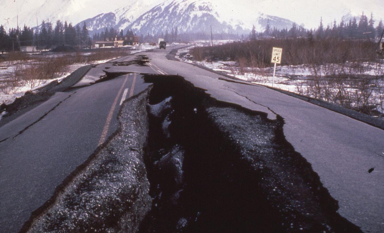
Alaska has more large earthquakes than the rest of the United States combined. More than three-quarters of the state’s population live in an area that can experience a magnitude 7 earthquake. Our research provides objective science that helps stakeholders prepare for and mitigate the effects of future earthquakes and tsunamis, which bolsters the economic health and well-being of Alaska and the Nation.
The Alaska Earthquake and Tsunami Hazards team conducts field-based research to understand how, where, and why earthquakes and tsunamis occur in Alaska. Our research examines earthquake hazards that contribute to societal risk in Alaska and beyond, including earthquake ground motion, fault slip, surface deformation, landslides and liquefaction triggered by strong ground shaking, and tsunamis.
Earthquake and Tsunami Safety:
Earthquakes – Drop Cover and Hold ON!
- Great Alaska Earthquake, 1964—Magnitude 9.2 —Causes & Effects (video 6:43)
- Alaska—Regional Tectonics and Earthquakes (video 8:39)
- Earthquake Intensity—What controls the shaking you feel? (video 8:17)
- Tectonic Plates—What are the lithospheric plates? (video 6:39)
- How to Prepare for an Earthquake
- What should I do During an earthquake? (USGS FAQs)
Tsunami – If you feel shaking for more than 20 seconds and it is difficult to stand, or the tsunami siren is heard move inland to higher ground.
- Valdez Prepared (Tsunami Awareness from 1964 to present) (video 6:10)
- Story Map: A Hidden Wave Emerges - Tsunami Hazard in Upper Cook Inlet
- Tsunamis in Alaska
- Coastal Alaska is Tsunami Country (Flyer)
- The 1964 Tsunami Propagation in the Pacific Ocean
Tsunamis Generated by Megathrust Earthquakes (video 5:43)
Wildland fires are increasing in size and intensity and addressing fire issues is complicated by invasive species, insects and disease outbreaks, human build-out into the wildlands, and changes in climate and weather patterns such as warming temperatures, periods of drought, and erratic rains. The USGS has researchers studying the impacts of wildland fires from Florida to Alaska.
Studying pre- and post-fire measurements of fire help ecologists, fire scientists, management agencies, states, tribes, landowners, and communities determine how the severity of wildfires affects plants, animal habitat, archaeological sites, and ecosystem services. To address future research questions, many USGS scientists, including Rachel Loehman with the Alaska Science Center, contributed to the U.S. Geological Survey Wildland Fire Science Strategic Plan, 2021–26.
Climate changes and interacting disturbances such as wildfires, insect and disease outbreaks, and erosion and flooding can perturb and reorganize ecosystems. Disturbances that are large and severe or that are beyond the bounds of historical range of variability can abruptly reorganize ecosystems, posing serious threats to ecosystem integrity and resilience. Sudden and persistent changes in biological and physical environments impact animal and human communities and pose great challenges for land and resource management.
Landslides
Landslides occur in all 50 states and territories, and they affect lives, property, infrastructure, and the environment. Understanding when, where, and how landslides occur can help to reduce the risk of living with these natural hazards.
- Landslides are the downslope movement of earth materials (rock, debris, and soil) at rates that range from inches per year to tens of miles per hour.
- Some landslides can move faster than a person can run.
- Landslides can happen with no notice or can take place over a period of days, weeks, or longer.
Landslides are dangerous and very difficult to predict. Some landslides may provide clues that they are about to happen; others may happen suddenly without any warning signs.
Landslide Basics
Story Map - Monitoring Efforts at the Barry Arm Landslide
Video: Prince William Sound Landslide Hazards
Feature Story: Assessing Landslide Risks in Prince William Sound
Get Our News
These items are in the RSS feed format (Really Simple Syndication) based on categories such as topics, locations, and more. You can install an RSS reader browser extension, software, or use a third-party service to receive immediate news updates depending on the feed that you have added. If you click the feed links below, they may look strange because they are simply XML code. An RSS reader can easily read this code and push out a notification to you when something new is posted to our site.


