
The River Runs Red
By Brandon Sansom, PhD and Robert Jacobson, PhD
May 17, 2021
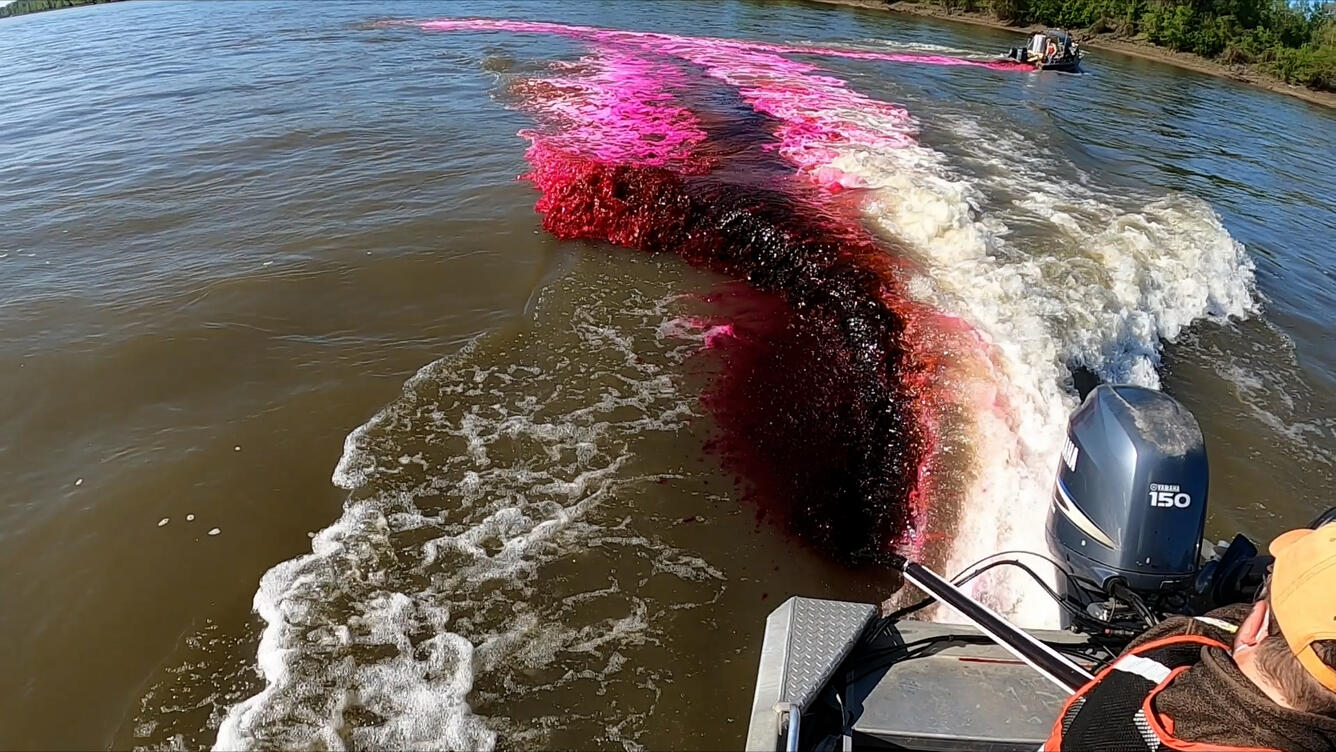
The execution of the dye-trace experiment required coordinated efforts between several boat operators, unmanned aerial systems (UAS) pilots, and a fixed-wing-aircraft pilot. The release of the dye occurred at 9:00 am on May 5 and required precise preparation and communication between the fixed-wing-aircraft pilot and the crew on the water responsible for releasing the dye into the river. In total, 16 CERC scientists and technicians were spread across seven boats assisting with the dye-release. Two boats were responsible for lining up along the channel center and simultaneously releasing the dye into the river as the boats drove towards opposite banks and as the aircraft made its first pass. A boat located about two miles downstream of the dye release location was equipped with a fluorometer, spectroscopy equipment, and an acoustic Doppler current profiler (ADCP) to monitor the concentration of the dye and characterize the depth and water velocity as the dye passed by. Two other boats were also equipped with ADCP’s and characterized the depth and water velocity at select transects throughout the entire reach while the remaining two boats assisted with deploying fluorometers throughout the study reach and documenting the study with video and photography.


In addition to the crew on the water, multiple aircraft were flying above the reach and documenting the movement of dye downstream. Four additional scientists from USGS and Missouri University of Science and Technology were flying UAS's to collect standard video and hyperspectral imagery as dye moved through the interception rearing complex (IRC) at Searcy’s Bend. Multispectral imagery of the entire 7-mile experimental reach was acquired by fixed-wing aircraft 8 times during the experiment in 20 minute passes.
