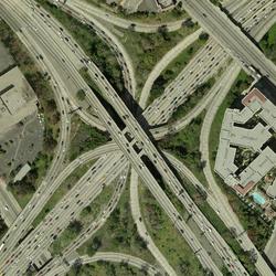
Lesson 5: Using The National Map Web Services in ArcMap - This video provides an overview and demonstrates how to use The National Map's web services in a mapping application.
What are the URLs for imagery services in The National Map, and are they cached or dynamic?
There are several imagery services for The National Map. Some imagery services are cached and some are dynamic:
-
USGSImageryOnly (under Base Maps), for example, is a tile cache base map service of orthoimagery. It has different imagery data sources depending on view scale. The USGSImageryOnly service uses cache tiles of 256x256 pixels in size and 96 dots per inch (dpi) resolution with 75% compression quality.
- NAIP Plus (under Theme Overlays) is an example of a dynamic map service. It includes 1-meter resolution data from the National Agriculture Imagery Program (NAIP).
Learn more: Video lessons for using The National Map Products and Services
Related
What is the difference between tiled and dynamic services?
What sources were used for imagery in The National Map services?
What projection are the imagery services in The National Map viewer?
Why does my orthoimagery search on The National Map return multiple tiles for downloading?
What do the different colors in a color-infrared aerial photograph represent?
Will I be able to see my house in an aerial photograph? Will enlarging the image let me see more detail?
How do I download orthoimagery products and what are the available formats?
Lesson 5: Using The National Map Web Services in ArcMap - This video provides an overview and demonstrates how to use The National Map's web services in a mapping application.
Digital orthoimagery base specification V1.0
The National Map - Orthoimagery
Related
What is the difference between tiled and dynamic services?
What sources were used for imagery in The National Map services?
What projection are the imagery services in The National Map viewer?
Why does my orthoimagery search on The National Map return multiple tiles for downloading?
What do the different colors in a color-infrared aerial photograph represent?
Will I be able to see my house in an aerial photograph? Will enlarging the image let me see more detail?
How do I download orthoimagery products and what are the available formats?
Lesson 5: Using The National Map Web Services in ArcMap - This video provides an overview and demonstrates how to use The National Map's web services in a mapping application.
Lesson 5: Using The National Map Web Services in ArcMap - This video provides an overview and demonstrates how to use The National Map's web services in a mapping application.


