


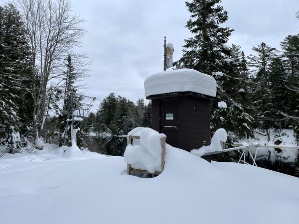
Streamgage 04045500 Tahquamenon River Near Paradise, Michigan, covered in snow on a December day.
https://waterdata.usgs.gov/monitoring-location/04045500/

Official websites use .gov
A .gov website belongs to an official government organization in the United States.
Secure .gov websites use HTTPS
A lock () or https:// means you’ve safely connected to the .gov website. Share sensitive information only on official, secure websites.
Stream stage (aka gage height) is an important concept when analyzing how much water is moving in a stream at any given moment. "Stage" is the water level above some arbitrary point in the river and is commonly measured in feet. For example, on a normal day when no rain has fallen for a while, a river might have a stage of 2 feet. If a big storm hits, the river stage could rise to 15 or 20 feet, sometimes very quickly. This is important because past records might tell us that when the stage hits 21 feet, the water will start flowing over its banks and into the basements of houses along the river -- time to tell those people to move out! With modern technology, the USGS can monitor the stage of many streams almost instantly.
Hydrologists are able to convert stage height into streamflow volume by determining a rating curve for each site.
Learn more:
Streamgage 04045500 Tahquamenon River Near Paradise, Michigan, covered in snow on a December day.
https://waterdata.usgs.gov/monitoring-location/04045500/
Streamgage 04045500 Tahquamenon River Near Paradise, Michigan, covered in snow on a December day.
https://waterdata.usgs.gov/monitoring-location/04045500/

USGS Scientist makes a gage inspection during the rain event at Nepaug River near Nepaug, Connecticut - 01187800. The 1800 cubic feet per second (CFS) measured during the powerful rainstorm was the highest measurement on record to date, according to provisional data.
USGS Scientist makes a gage inspection during the rain event at Nepaug River near Nepaug, Connecticut - 01187800. The 1800 cubic feet per second (CFS) measured during the powerful rainstorm was the highest measurement on record to date, according to provisional data.

Hydrologist installs streamgage at Birch Creek below Heart Butte Road, near Heart Butte, MT (06094900) as part of the surface water phase of the Hydrologic Assessment of the Blackfeet Reservation, Montana project.
Hydrologist installs streamgage at Birch Creek below Heart Butte Road, near Heart Butte, MT (06094900) as part of the surface water phase of the Hydrologic Assessment of the Blackfeet Reservation, Montana project.

The wire weight is lowered to determine stage of Bull Lake Creek above Bull Lake
The wire weight is lowered to determine stage of Bull Lake Creek above Bull Lake

USGS staff gage (ruler) measuring the height of the water, on the Carson River, near Brunswick Canyon, Nevada.
USGS staff gage (ruler) measuring the height of the water, on the Carson River, near Brunswick Canyon, Nevada.

A staff gage at the Bonnet Carré Spillway, which is managed by the U.S. Army Corps of Engineers.
A staff gage at the Bonnet Carré Spillway, which is managed by the U.S. Army Corps of Engineers.

A USGS streamgage measures flooding in the lower Trinity River, Texas.
A USGS streamgage measures flooding in the lower Trinity River, Texas.

USGS employee, Hanna Coy, talks about stream gauging.
USGS employee, Hanna Coy, talks about stream gauging.

Water level measurement from the USGS Red River of the North at Fargo streamgage in downtown Fargo, ND. The water level peaked at around 39 feet at this streamgage on April 9. Real-time water level and streamflow data from this gage can be accessed online.
Water level measurement from the USGS Red River of the North at Fargo streamgage in downtown Fargo, ND. The water level peaked at around 39 feet at this streamgage on April 9. Real-time water level and streamflow data from this gage can be accessed online.

Whether you drink water from your tap, use electricity or canoe down your local river, chances are you benefit from USGS streamgage information. So what is a streamgage and what does it do for you? This CoreCast episode gives you the inside scoop on your silent superhero.
Transcript and captions available soon.

White building that houses the Corwin Springs streamgage on the Yellowstone River in southwest Montana.
White building that houses the Corwin Springs streamgage on the Yellowstone River in southwest Montana.
Streamgage 04045500 Tahquamenon River Near Paradise, Michigan, covered in snow on a December day.
https://waterdata.usgs.gov/monitoring-location/04045500/
Streamgage 04045500 Tahquamenon River Near Paradise, Michigan, covered in snow on a December day.
https://waterdata.usgs.gov/monitoring-location/04045500/
USGS Scientist makes a gage inspection during the rain event at Nepaug River near Nepaug, Connecticut - 01187800. The 1800 cubic feet per second (CFS) measured during the powerful rainstorm was the highest measurement on record to date, according to provisional data.
USGS Scientist makes a gage inspection during the rain event at Nepaug River near Nepaug, Connecticut - 01187800. The 1800 cubic feet per second (CFS) measured during the powerful rainstorm was the highest measurement on record to date, according to provisional data.
Hydrologist installs streamgage at Birch Creek below Heart Butte Road, near Heart Butte, MT (06094900) as part of the surface water phase of the Hydrologic Assessment of the Blackfeet Reservation, Montana project.
Hydrologist installs streamgage at Birch Creek below Heart Butte Road, near Heart Butte, MT (06094900) as part of the surface water phase of the Hydrologic Assessment of the Blackfeet Reservation, Montana project.
The wire weight is lowered to determine stage of Bull Lake Creek above Bull Lake
The wire weight is lowered to determine stage of Bull Lake Creek above Bull Lake
USGS staff gage (ruler) measuring the height of the water, on the Carson River, near Brunswick Canyon, Nevada.
USGS staff gage (ruler) measuring the height of the water, on the Carson River, near Brunswick Canyon, Nevada.
A staff gage at the Bonnet Carré Spillway, which is managed by the U.S. Army Corps of Engineers.
A staff gage at the Bonnet Carré Spillway, which is managed by the U.S. Army Corps of Engineers.
A USGS streamgage measures flooding in the lower Trinity River, Texas.
A USGS streamgage measures flooding in the lower Trinity River, Texas.
USGS employee, Hanna Coy, talks about stream gauging.
USGS employee, Hanna Coy, talks about stream gauging.
Water level measurement from the USGS Red River of the North at Fargo streamgage in downtown Fargo, ND. The water level peaked at around 39 feet at this streamgage on April 9. Real-time water level and streamflow data from this gage can be accessed online.
Water level measurement from the USGS Red River of the North at Fargo streamgage in downtown Fargo, ND. The water level peaked at around 39 feet at this streamgage on April 9. Real-time water level and streamflow data from this gage can be accessed online.
Whether you drink water from your tap, use electricity or canoe down your local river, chances are you benefit from USGS streamgage information. So what is a streamgage and what does it do for you? This CoreCast episode gives you the inside scoop on your silent superhero.
Transcript and captions available soon.
White building that houses the Corwin Springs streamgage on the Yellowstone River in southwest Montana.
White building that houses the Corwin Springs streamgage on the Yellowstone River in southwest Montana.