
Ecology of Cape Cod National Seashore
Learn about the ecology of Cape Cod National Seashore.
A variety of ecosystems can be found on Cape Cod including marine, estuarine, freshwater, and terrestrial. These ecosystems provide habitat for an abundance of plant and animal life. Pitch pine and scrub oak forests, heath lands, sand plain grasslands, and dunes make up the terrestrial ecosystems. Heathlands and sandplain grasslands are a direct result of Cape Cod’s glacial past. They lie on top of the sandy sediments left behind as the glaciers retreated. The grasslands are also a result of past disturbances by either settlers or fires. Without these disturbances, these ecosystems would likely be replaced with forests. Heathlands and grasslands are a unique ecosystem that provide habitat for similarly unique animals such as the vesper and grassland sparrow, which are types of open-land birds.
Dunes on Cape Cod are a result of a variety of interconnected forces including glacial activity, erosion, deposition, and destabilization of the ground surface by early settlers. Dunes are a prominent feature on Cape Cod National Seashore covering about one-third of the land surface. Plants that grow on the dunes are uniquely adapted to endure the harsh conditions of their sandy, windy environment. Vegetation helps to stabilize the dunes and combat erosion.
Freshwater ecosystems on Cape Cod, like most aspects of the peninsula, are a direct result of a glacial past. Kettle ponds are formed when the kettle holes discussed earlier are deep enough to intersect with the water table, thereby flooding the depression and creating a pond or lake. These special habitats provide refuge for a number of species including 12 different types of amphibians. Among those species is the remarkable eastern spadefoot toad. Spadefoot toads spend most of the time hiding underground, emerging only occasionally on warm, rainy nights to breed. A variety of reptiles are also associated with these freshwater ecosystems. The eastern hognose snake consumes almost exclusively on the toads that can be found near the kettle ponds. When threatened, the eastern hognose will rear up and hiss like a cobra and then roll over and play dead. A notable number of terrestrial eastern box turtles can be found on Cape Cod as well.

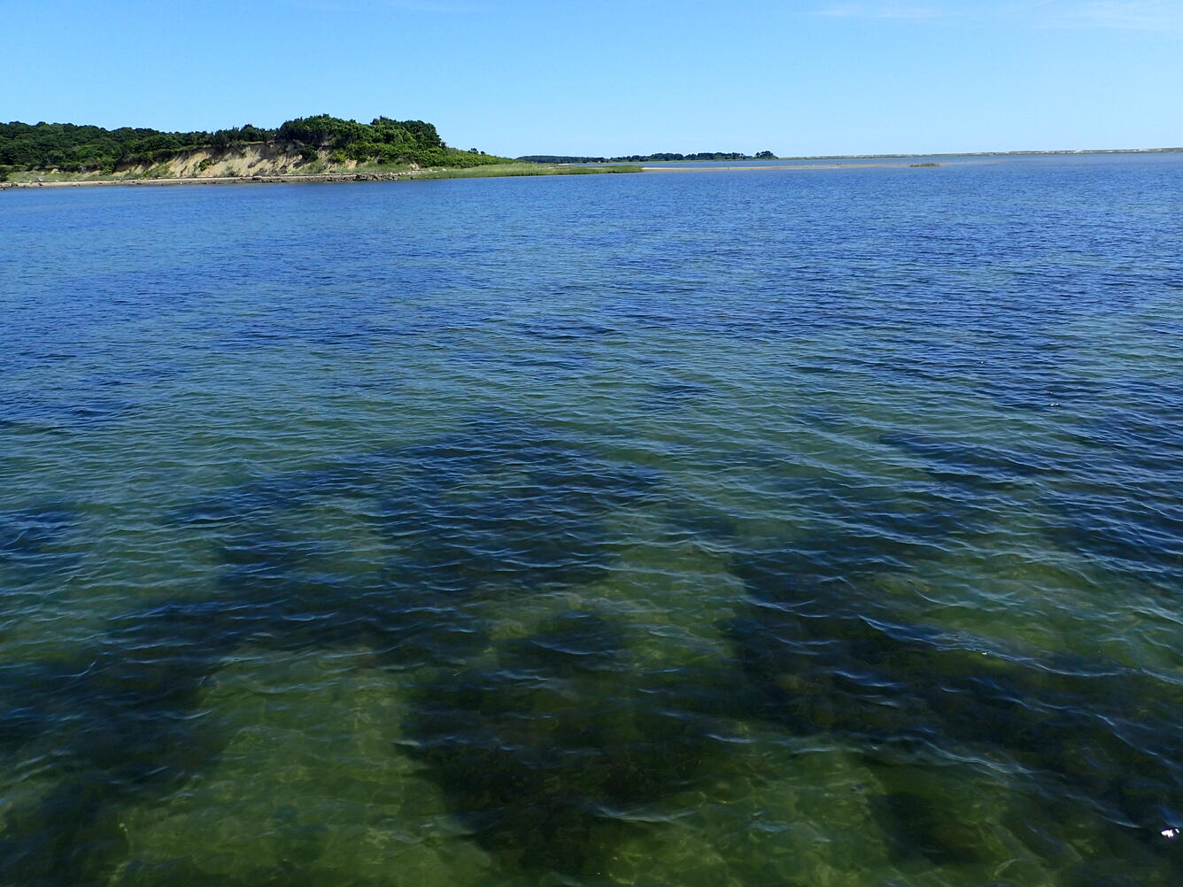
Salt marshes and estuaries are prominent features of the Cape Cod landscape. Estuaries are places where saltwater and fresh water meet. These are extremely biologically diverse and productive ecosystems. Salt marshes filter out excess nutrients and provide habitat for fish, shellfish, and birds. Beyond the estuaries and saltmarshes, the Atlantic Ocean also teems with life just off the coast. Up-welling of cold, nutrient rich water support food sources for seals, sharks, dolphins, whales, and seabirds. In the summer, endangered North Atlantic right whales and humpback whales use the waters off the coast of Cape Cod for feeding and as a nursery ground. Colonies of seals can also be found in the summer, both in the ocean and on the shore.
All of these ecosystems from the oceans to the freshwater ponds and the grasslands provide habitat for over 370 different species of birds. Migratory birds that will fly as far north as the Artic and as far south as Antarctica rest and feed on Cape Cod. Among these many bird species that make Cape Cod home is the piping plover, a once endangered species. Although these tiny birds have rebounded from their smallest numbers, they are still a threatened species.
Surrounded by salty ocean water on three-sides, freshwater is a major concern on Cape Cod. All of the drinking water, and most of the freshwater for agricultural, industrial, and domestic purposes on the peninsula comes from groundwater. Groundwater is vulnerable to contamination and depletion. The USGS has been researching ground and surface-water on Cape Cod for over 50 years to help inform decision-making regarding this vital resource.
Recent studies have investigated the effect of climate change on groundwater and surface-water, sources of water to ponds, streams, coastal areas, and public-supply wells, as well as the transport of discharge of nitrogen from wastewater. USGS has also been involved with monitoring groundwater contamination of the underlying glacial aquifer at the Joint Base Cape Cod. This work helps to protect the communities that rely on that aquifer as their only source of freshwater.
USGS is also involved with research off the coast of Cape Cod in the Atlantic Ocean. In 2013, USGS participated in a joint expedition with NOAA and other organizations to explore deep sea canyons offshore of the Northeast United States. These canyons, which cut into the edge of the continent margin, can be thousands of meters of deep. Thus, scientists on the expedition used a special remotely operated vehicle (ROV) for exploration. The ROV captured fascinating images of the creatures that make their home in these dark and deep environments.

Surprisingly, these canyons are areas of high productivity in the deep sea. Organic matter and sediment collect and are concentrated in the canyons allowing them to support a diversity of life, including cold-water corals and commercially important fisheries. These canyons are also associated with submarine landslides and hydrocarbon seeps. The research expedition will help scientists to better understand the unique biological, ecological, and geological processes occurring in the deep-sea canyons.
USGS also conducts important research at the Woods Hole Coastal and Marine Science Center which is located on Cape Cod. Woods Hole is one of three centers associated with the USGS Coastal/Marine Hazards and Resources Program (CMHRP). Work at the USGS Woods Hole Coastal and Marine Science Center focuses on six key topic areas: Coastal and Shelf Geology, Sediment Transport, Energy and Geohazards, Environmental Geoscience, Sea-Floor Mapping, Information Science. Their work is not just limited to Massachusetts or New England but spans the nation. In 2018, USGS Woods Hole scientists worked on a vast diversity of projects from providing support during the Mount Kilauea Volcanic Eruption in Hawaii to restoring salt marshes in the Herring River in Wellfleet, Massachusetts. and mapping the seafloor off the coasts of New Jersey, Delaware, Maryland, and Virginia.