
Hydrologic Technician Andy Cloutier visited USGS gaging station 01069500 on the Mousam River at West Kennebunk, Maine in mid-April of 2021.
Images
New England Water Science Center Images
Filter Total Items: 478

Mousam River at West Kennebunk, Maine
Hydrologic Technician Andy Cloutier visited USGS gaging station 01069500 on the Mousam River at West Kennebunk, Maine in mid-April of 2021.

Continuous stage only gaging station
Continuous stage only gaging station located at Mystic River at Rt. 1 bridge, Connecticut (USGS Site ID 412117071580800)
Continuous stage only gaging station located at Mystic River at Rt. 1 bridge, Connecticut (USGS Site ID 412117071580800)

Tidal monitoring gage
Tidal monitoring gage on a drawbridge over the Mystic River in Mystic, Connecticut.
Tidal monitoring gage on a drawbridge over the Mystic River in Mystic, Connecticut.

Burlington Falls on Bunnell Brook
Studying the mountain streams and rivers of New England means never being too far from a scenic and historic waterfall, like the Burlington Falls on Bunnell Brook pictured here. This natural resource attracted small industries to a mostly rural Burlington, CT in the early-19th century.
Studying the mountain streams and rivers of New England means never being too far from a scenic and historic waterfall, like the Burlington Falls on Bunnell Brook pictured here. This natural resource attracted small industries to a mostly rural Burlington, CT in the early-19th century.

Gainer Memorial Dam, Scituate Reservoir, Rhode Island
The north side of the Gainer Memorial Dam, Scituate Reservoir, Rhode Island.
The north side of the Gainer Memorial Dam, Scituate Reservoir, Rhode Island.

Gainer Memorial Dam, Rhode Island
The south side of the Gainer Memorial Dam, Scituate Reservoir, Rhode Island. The reservoir began storing water on November 10, 1925.
The south side of the Gainer Memorial Dam, Scituate Reservoir, Rhode Island. The reservoir began storing water on November 10, 1925.

Latimer Brook High Flow
A long exposure shot shows the flow and direction of water through the gage pool during a high-flow event in April 2021. Looking upstream you can see the staff plate and a felled tree which is not impacting flow.
A long exposure shot shows the flow and direction of water through the gage pool during a high-flow event in April 2021. Looking upstream you can see the staff plate and a felled tree which is not impacting flow.

Block Island Sound view from shore of Block Island, Rhode Island
Block Island Sound view from shore of Block Island, Rhode Island. Tall grass on the beach and a cargo ship in the background.
Block Island Sound view from shore of Block Island, Rhode Island. Tall grass on the beach and a cargo ship in the background.

Block Island Sound
Block Island Sound from shore of Block Island, Rhode Island. A ferry making its way to a shore in the background.
Block Island Sound from shore of Block Island, Rhode Island. A ferry making its way to a shore in the background.
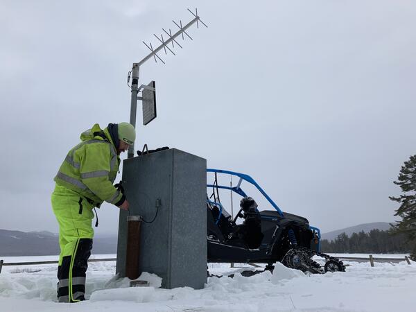
Winter Groundwater Comparisons at Middle Dam, Maine
Hydrologic technician making groundwater measurements and inspecting the USGS groundwater site monitoring equipment.
Hydrologic technician making groundwater measurements and inspecting the USGS groundwater site monitoring equipment.

USGS scientists collecting lake-bottom sediments
USGS scientists collecting lake-bottom sediments from Ashumet Pond on Cape Cod, Massachusetts for use in laboratory experiments on the fate of PFAS at groundwater/surface-water boundaries. The sediments are collected by pushing a tube into the lake bottom and transferring the sediment and pore water into glass jars.
USGS scientists collecting lake-bottom sediments from Ashumet Pond on Cape Cod, Massachusetts for use in laboratory experiments on the fate of PFAS at groundwater/surface-water boundaries. The sediments are collected by pushing a tube into the lake bottom and transferring the sediment and pore water into glass jars.

Collecting an isokinetic equal-width increment water sample
Photograph of U.S. Geological Survey technician collecting an isokinetic equal-width increment water sample at USGS streamgage 01115265, Hemlock Brook at King Road near Foster, Rhode Island.
Photograph of U.S. Geological Survey technician collecting an isokinetic equal-width increment water sample at USGS streamgage 01115265, Hemlock Brook at King Road near Foster, Rhode Island.

Precipitation measurement and sampling at a meteorological platform
The photo shows a Belfort Weighing Bucket, Tipping Bucket, Aerochem, Ott Pluvio , Hubbard Brook, and standard rain gage. Sleepers River Research Watershed, Danville, Vermont.
The photo shows a Belfort Weighing Bucket, Tipping Bucket, Aerochem, Ott Pluvio , Hubbard Brook, and standard rain gage. Sleepers River Research Watershed, Danville, Vermont.

USGS employees on boat
Photo Contest Winner | March 2021 | People
USGS employees on boat
Photo Contest Winner | March 2021 | People
USGS employees on boat

Frost tube
Photo of a recently retrieved frost tube during the Snow Depth and Snow Water Equivalent (SWE) measurement. Sleepers River Research Watershed, Danville, Vermont.
Photo of a recently retrieved frost tube during the Snow Depth and Snow Water Equivalent (SWE) measurement. Sleepers River Research Watershed, Danville, Vermont.


Sandy River Gaging Station
USGS gaging station on the Sandy River near Mercer, Maine, station 01048000 during winter.
USGS gaging station on the Sandy River near Mercer, Maine, station 01048000 during winter.

Segreganset River at North Dighton, Massachusetts
Winter scenery of the Segreganset River at North Dighton, Massachusetts, February 12, 2021.
Winter scenery of the Segreganset River at North Dighton, Massachusetts, February 12, 2021.

Winter Groundwater Site Inspection
Photo Contest Winner | March 2021 | Honorable Mention
423441072170701 MA-ORW63 Winter Groundwater Site Inspection
Photo Contest Winner | March 2021 | Honorable Mention
423441072170701 MA-ORW63 Winter Groundwater Site Inspection

Stream with snow falling
A downstream view from the bridge during a blizzard, with ice forming on both edges of the river.
A downstream view from the bridge during a blizzard, with ice forming on both edges of the river.

Academy Cove, Wickford, Rhode Island
The USGS is conducting a study to characterize groundwater and surface water-quality to address the need for a better understanding of nutrient inputs to the coastal waters. The initial focus of the study is on local-scale hydrologic monitoring adjacent to Academy Cove.
The USGS is conducting a study to characterize groundwater and surface water-quality to address the need for a better understanding of nutrient inputs to the coastal waters. The initial focus of the study is on local-scale hydrologic monitoring adjacent to Academy Cove.