
High confidence DSWEmod water pixels (blue) from June 2016 covering South Lake Tahoe overlaid on top of a 2016 USDA NAIP image.
Images
Images intro.
Filter Total Items: 179

South Lake Tahoe June 2016
High confidence DSWEmod water pixels (blue) from June 2016 covering South Lake Tahoe overlaid on top of a 2016 USDA NAIP image.


Tidal marsh, Billy Frank Jr. Nisqually National Wildlife Refuge, WA.
A tidal marsh at Billy Frank Jr. Nisqually National Wildlife Refuge, WA.
A tidal marsh at Billy Frank Jr. Nisqually National Wildlife Refuge, WA.

Running stream
A picture of a flowing stream. Water is flowing over rocks creating a small waterfall. The vegetation along the stream bank is green and lush.
A picture of a flowing stream. Water is flowing over rocks creating a small waterfall. The vegetation along the stream bank is green and lush.

Potential State Changes Related to Drought, Fire and Grazing
Illustration of potential state changes related to drought, fire and grazing. Native grassland sites (1) can transition (A) to non-native dominated (2) when the fire regime is altered and grazing occurs. Re-introduction of fire (B) can help restore native grasses and reduce woody plant cover (3), especially with optimal timing and amount of precipitation (C, 1).
Illustration of potential state changes related to drought, fire and grazing. Native grassland sites (1) can transition (A) to non-native dominated (2) when the fire regime is altered and grazing occurs. Re-introduction of fire (B) can help restore native grasses and reduce woody plant cover (3), especially with optimal timing and amount of precipitation (C, 1).

Abandoned well pad site
Very old abandoned well pad site with vegetation cover.
Very old abandoned well pad site with vegetation cover.

Mature Salmon
A mature salmon returns to a shallow stream reach to spawn.
A mature salmon returns to a shallow stream reach to spawn.

Babacomari
Photograph of partners a.) designing the study, from left to right: Ron Pulliam (BR), Valer Austin (CLO), Miguel Villarreal (USGS), Anya Schoolman (WFF), Laura Norman (USGS), and David Seibert (BR; 1/29/13)
Photograph of partners a.) designing the study, from left to right: Ron Pulliam (BR), Valer Austin (CLO), Miguel Villarreal (USGS), Anya Schoolman (WFF), Laura Norman (USGS), and David Seibert (BR; 1/29/13)

Off-highway Vehicle (OHV) Tracks
Example of off-highway vehicles (OHV) tracks in a remote part of the Sonoran Desert.
Example of off-highway vehicles (OHV) tracks in a remote part of the Sonoran Desert.

Desert Grassland in Southern New Mexico
Desert grassland in southern New Mexico.
Desert grassland in southern New Mexico.

Mount Adams, WA
A photograph of Mount Adams, Washington. This image was taken as part of the Land Cover Trends Project field varification for land cover data.
A photograph of Mount Adams, Washington. This image was taken as part of the Land Cover Trends Project field varification for land cover data.

The Sonoran Desert of the Barry M. Goldwater Range in Arizona
A distressed desert in the Sonoran Desert of the Barry M. Goldwater Range in Arizona
A distressed desert in the Sonoran Desert of the Barry M. Goldwater Range in Arizona

Obtaining a Dredge Sample
Barbara Martin about to collect a sediment sample for selenium analysis. Sample collected from the agricultural drain Trifolium 19 on the southwest side of the Salton Sea, CA.
Barbara Martin about to collect a sediment sample for selenium analysis. Sample collected from the agricultural drain Trifolium 19 on the southwest side of the Salton Sea, CA.

A map of ShakeOut scenario shaking in southern California
A map of ShakeOut scenario shaking in southern California.
A map of ShakeOut scenario shaking in southern California.

Mountain range with hay field and forest in foreground in Colorado
Mountain range in the background, forest and hay field in the foreground. The picture was taken in Colorado during a field trip for the Land Cover Trends project.
Mountain range in the background, forest and hay field in the foreground. The picture was taken in Colorado during a field trip for the Land Cover Trends project.

Landscape in Washington state with forest, mountain, and houses
A landscape photograph of a valley with a mountain in the background. The valley consists of forests and residential housing.
A landscape photograph of a valley with a mountain in the background. The valley consists of forests and residential housing.
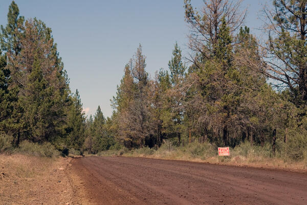
A pine forest with a dirt road running through it in Oregon
A pine forest with a dirt road running through it in Oregon. Photo taken as a part of field work during the Land Cover Trends project.
A pine forest with a dirt road running through it in Oregon. Photo taken as a part of field work during the Land Cover Trends project.

Cattle on rangeland on Mission Peak, near Fremont, CA.
Cattle on rangeland on Mission Peak, near Fremont, California, in the San Francisco Bay area. David Amme, California Native Grasslands Association.
Cattle on rangeland on Mission Peak, near Fremont, California, in the San Francisco Bay area. David Amme, California Native Grasslands Association.

Pronghorn in a Grassland
Pronghorn in a grassland on the San Carlos Apache Reservation. Five pronghorn are grazing on the rolling hills.
Pronghorn in a grassland on the San Carlos Apache Reservation. Five pronghorn are grazing on the rolling hills.

Salton Sea Sunset
Sunset on the southeast side of the Salton Sea, CA.
Sunset on the southeast side of the Salton Sea, CA.

California vineyard
A photo of a California (ecoregion 6) grape vine taken during field verifcation of Land Cover Trends project.
A photo of a California (ecoregion 6) grape vine taken during field verifcation of Land Cover Trends project.